Hiking in Austria: The Ultimate Guide
Your guide to hut-to-hut hiking in Austria: expert advice on Alpine regions, route choice, huts, booking timelines, weather patterns, and essential gear prep.
Quick links
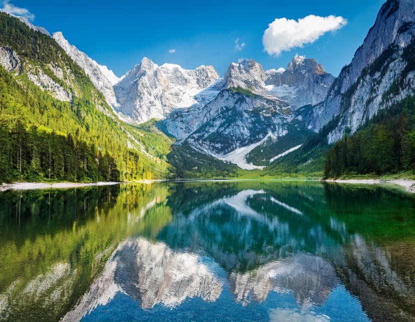
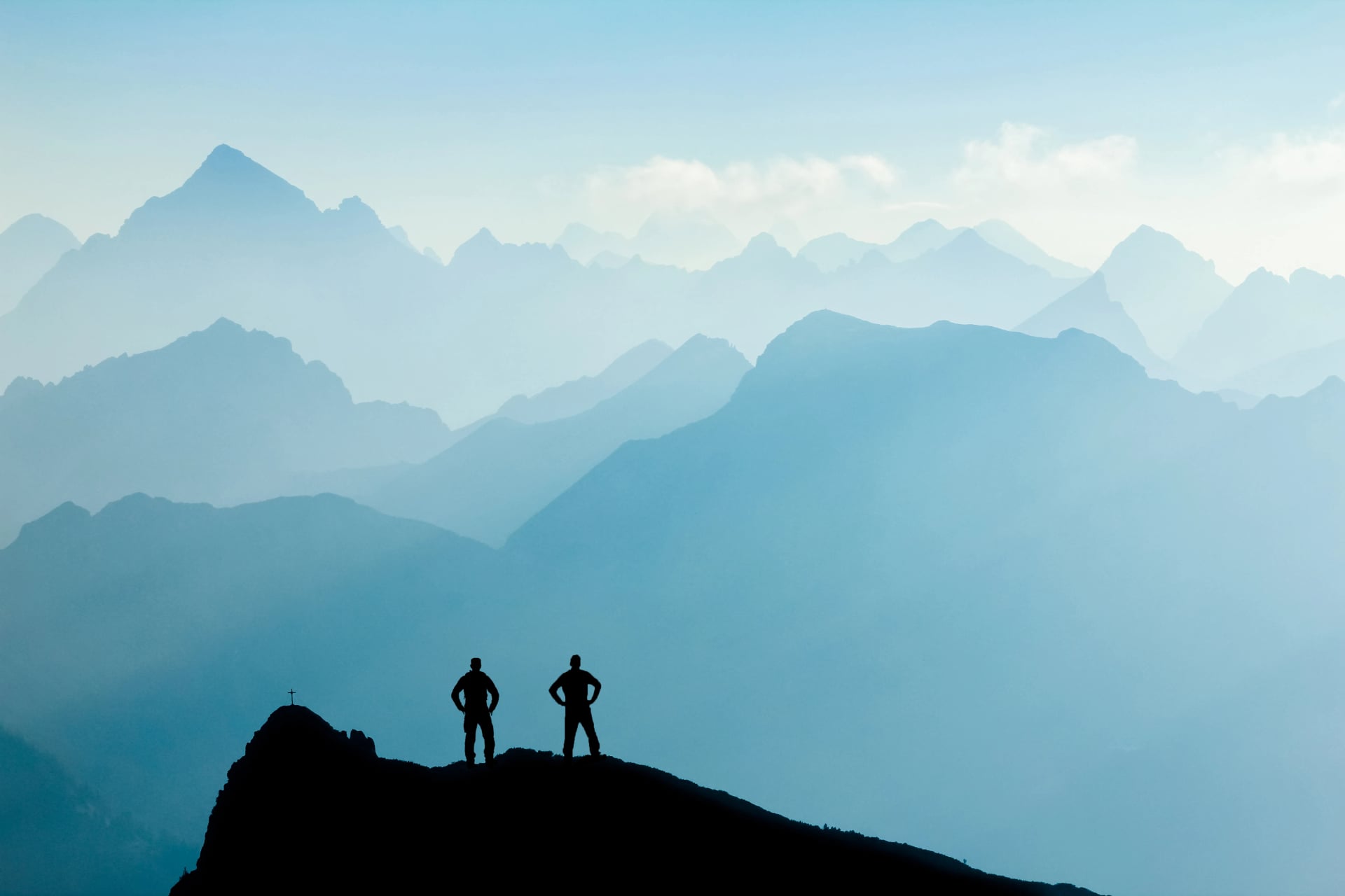
Austria offers one of Europe’s most complete alpine hiking environments, combining extensive mountain terrain with an unmatched hut network.
Austrian Hut-to-Hut Hiking at a Glance
Austria contains 29% of the entire Alpine range
Around 60% of the country is mountainous terrain
Routes span all difficulty levels, from valleys to high alpine passes
More than 500 mountain huts form one of Europe’s densest networks
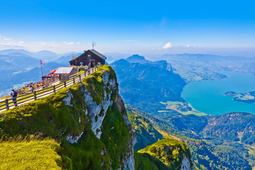
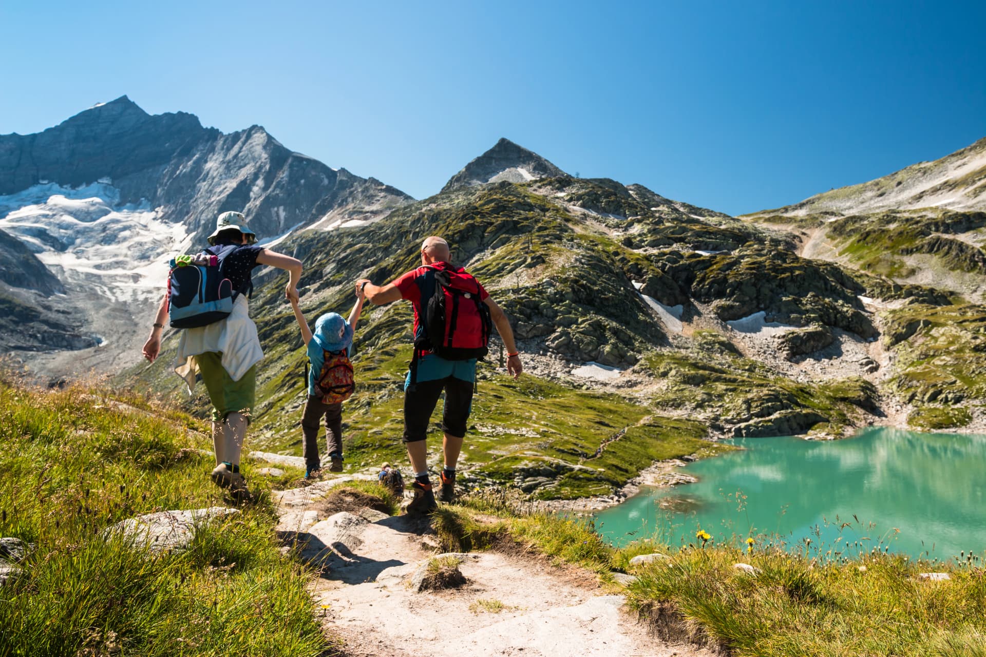
Overnight stays take place in huts on ridges and mountain passes
Multi-day routes are completed with only a daypack
Hut culture centers on communal meals and shared spaces
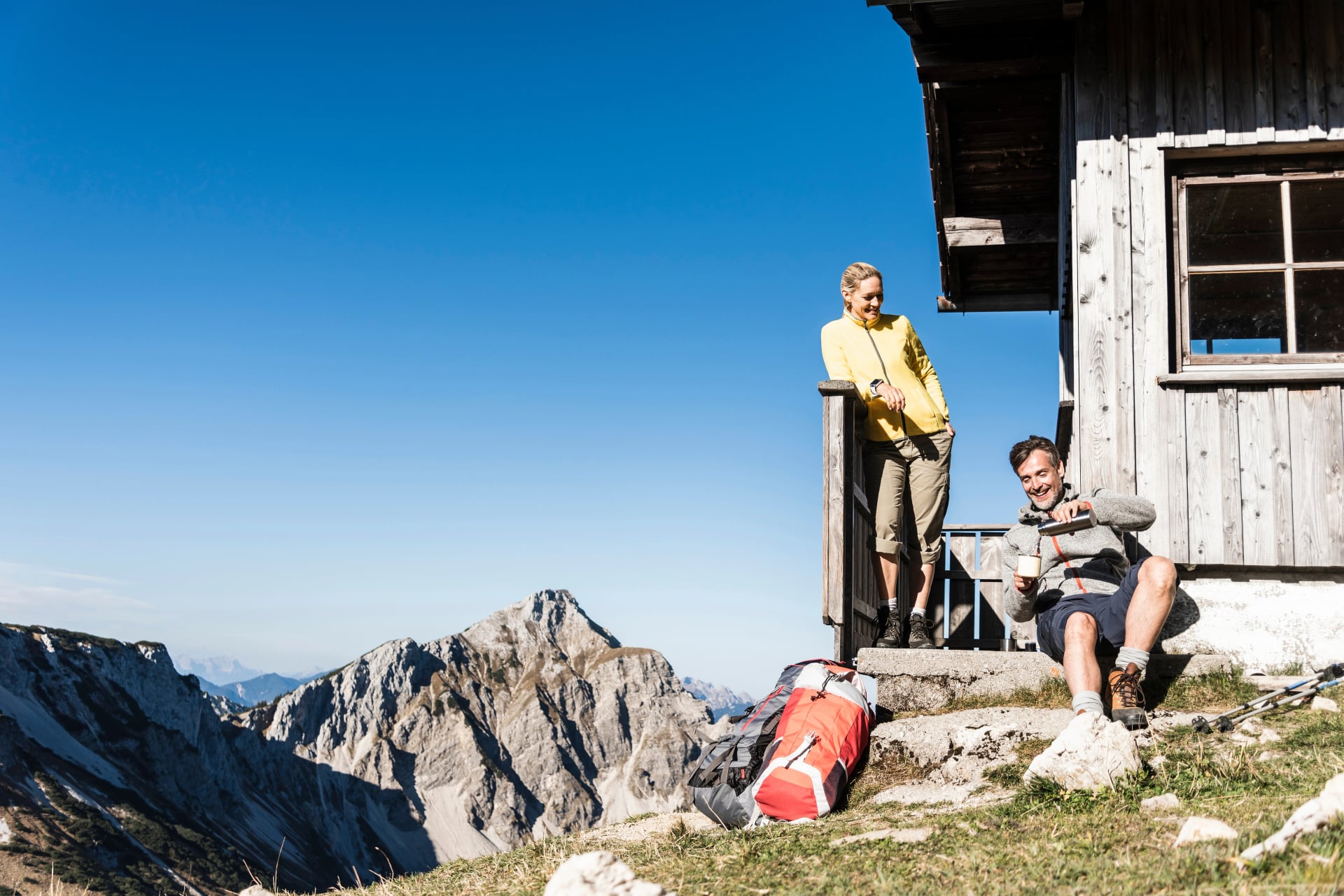
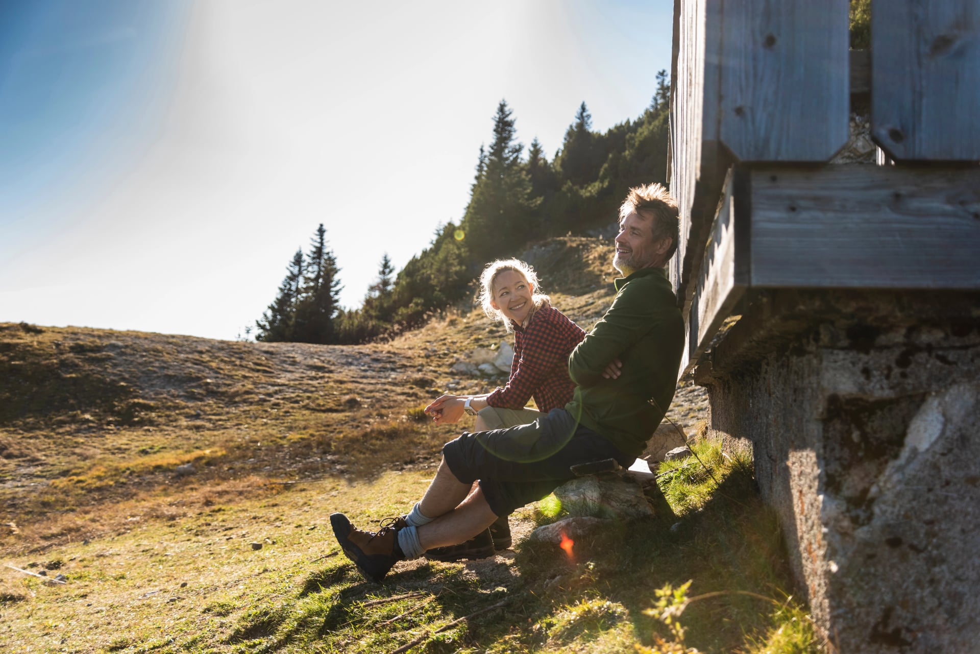
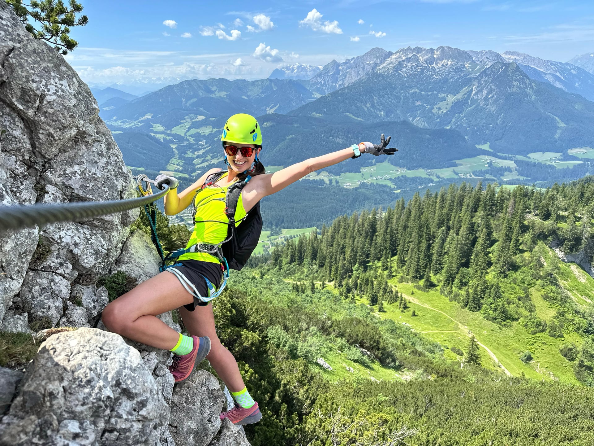
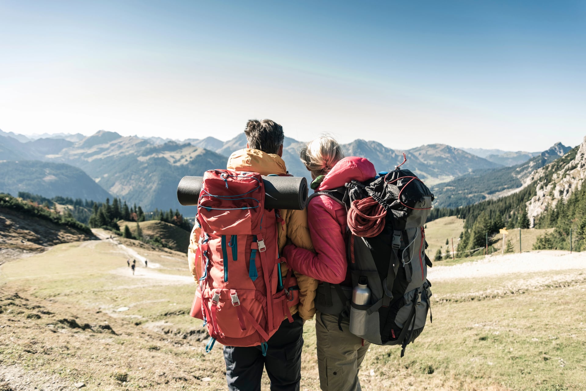
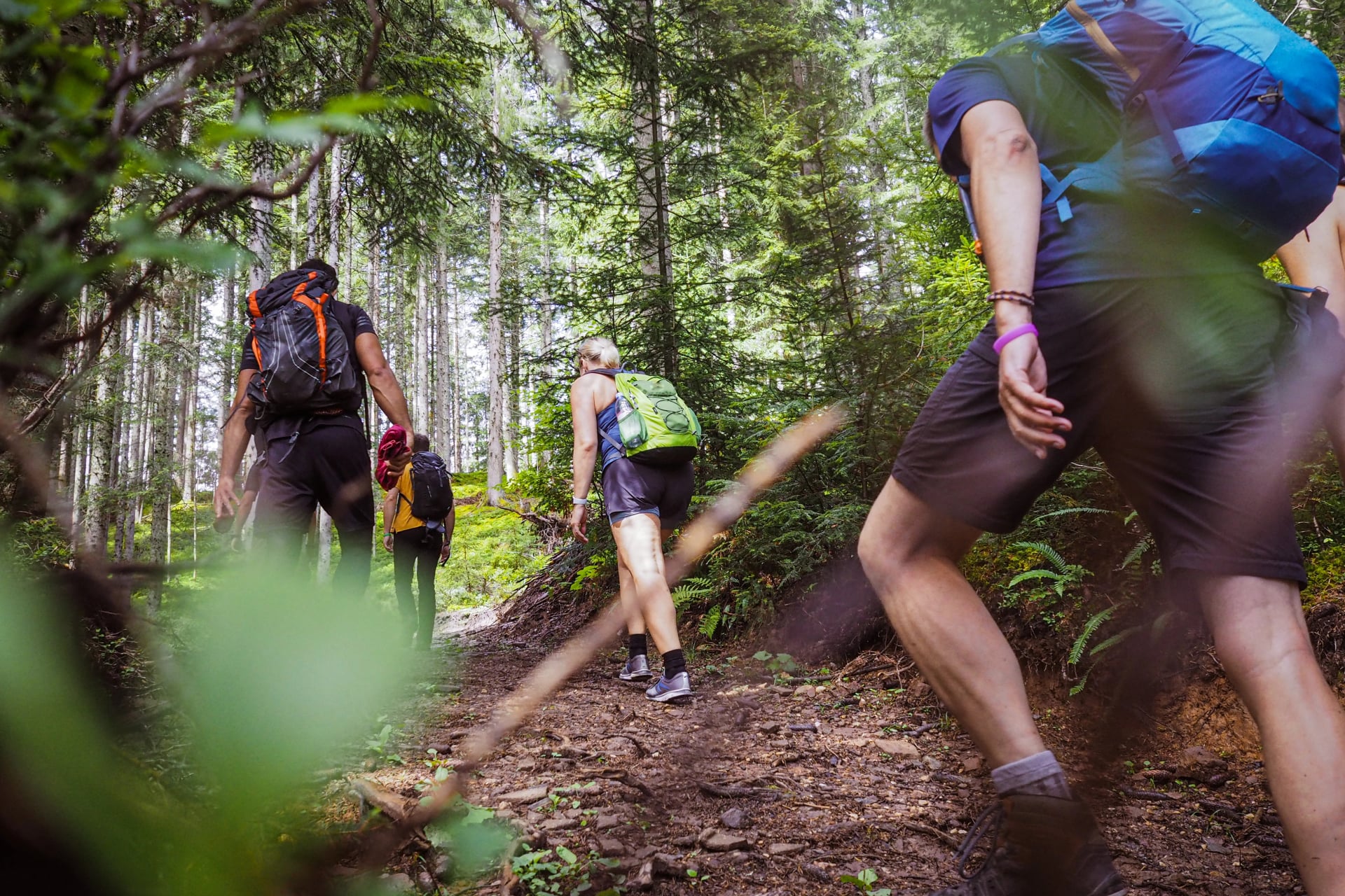
Hut-to-hut hiking represents the quintessential Austrian mountain experience: multi-day treks crossing high passes and ridges, moving each night to a new mountain hut, carrying only essentials while a warm meal and a bed await at the end of each stage. It is Alpine trekking without the burden of camping gear—combining physical challenge with cultural immersion and genuine mountain hospitality.
This guide will explain what hut-to-hut hiking in Austria involves, which regions and routes align with different experience levels, how to prepare physically and logistically, and why the Austrian Alps remain one of Europe’s most rewarding long-distance hiking destinations.
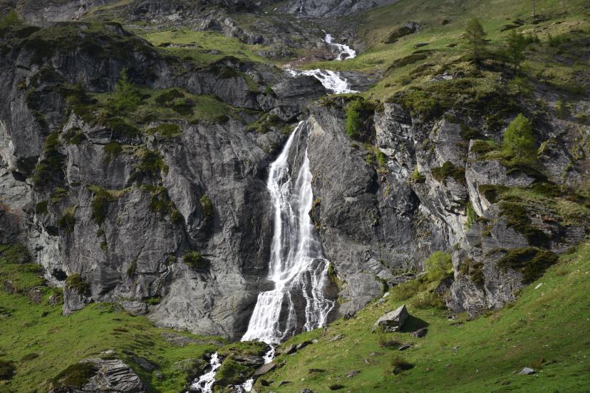
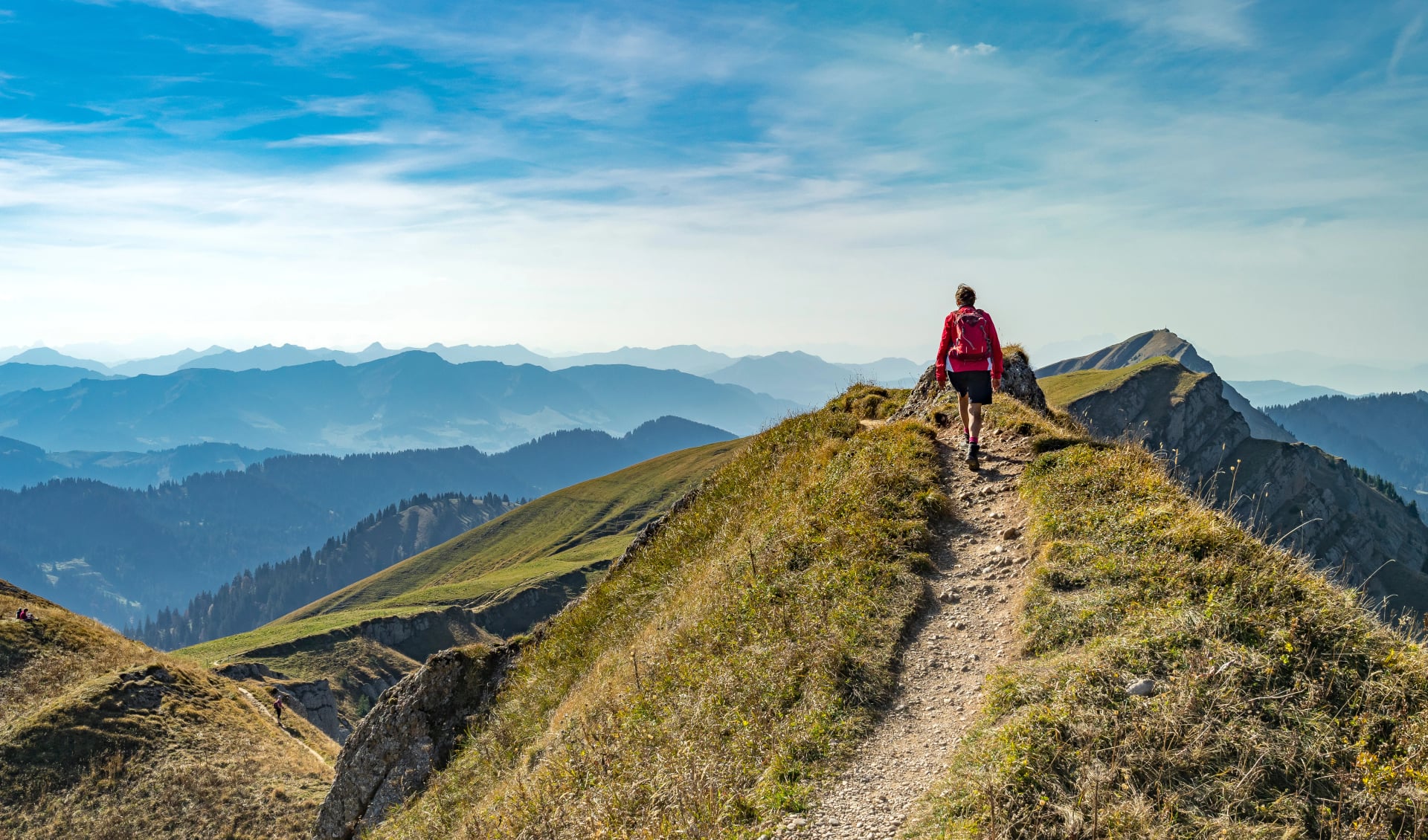
Austria's Alpine Regions for Hiking
Austria's Alps divide into distinct regions, each offering unique landscapes, trail character, and hiking experiences. Understanding these regional differences helps you choose the perfect area for your trekking goals and experience level.
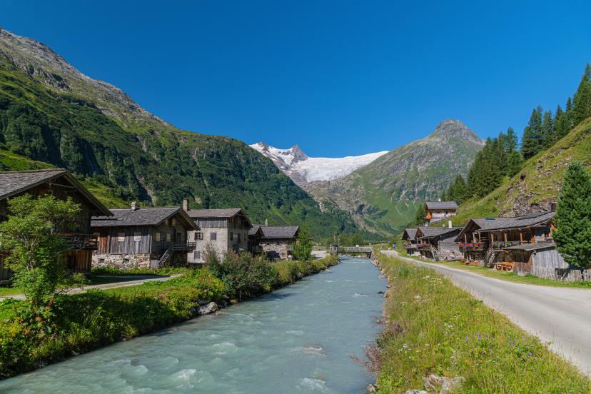
Tyrol & Ötztal Alps
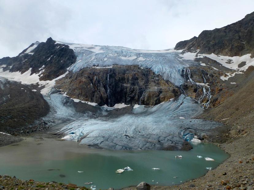
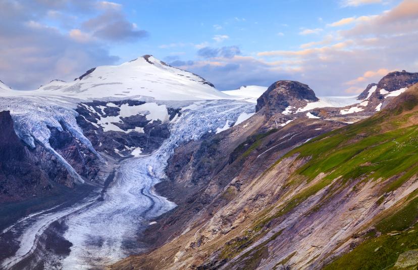
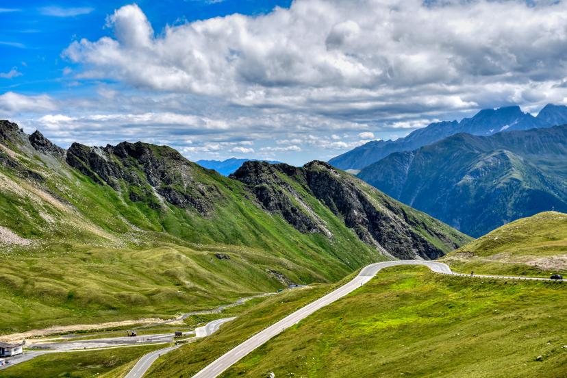
The heart of Austrian Alpine culture, Tyrol hosts some of the country's most dramatic high-altitude terrain. The Ötztal and Stubai Alps feature extensive glacier coverage, rocky high passes above 2,500m, and challenging multi-day circuits that demand fitness and mountain experience. The landscape here is stark, glaciated, and genuinely high-Alpine—this is Austria at its most spectacular and demanding.
Highlights:
See our featured hikes in this region:
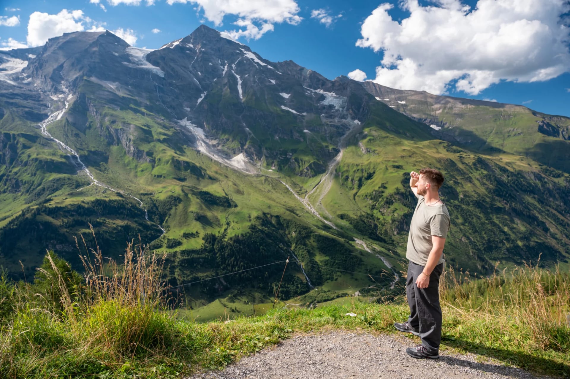
Salzburg & Hohe Tauern National Park
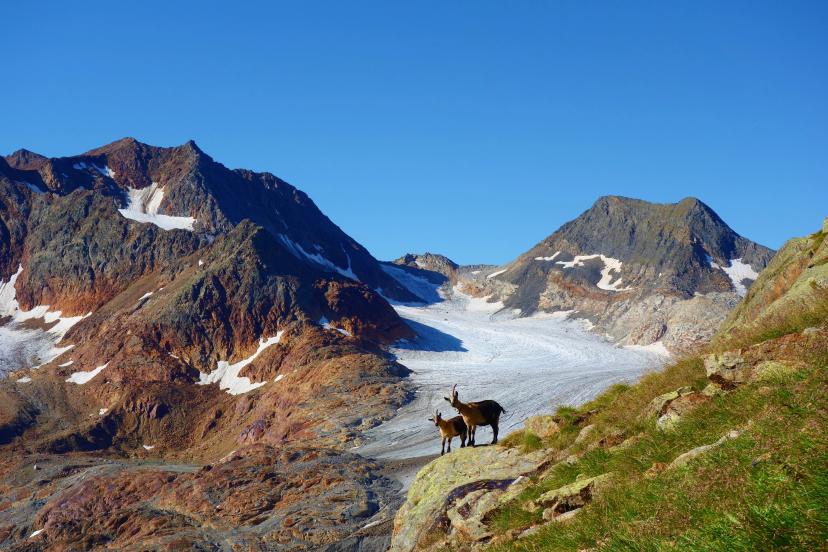
Home to Austria's highest peaks including Grossglockner (3,798m), this region combines dramatic Alpine scenery with protected wilderness. Hohe Tauern National Park is Austria's largest, offering exceptional wildlife viewing—chamois, ibex, golden eagles, and marmots—alongside glacier-fed valleys and high mountain passes. The trails here balance challenging high-altitude sections with gentler valley approaches, making them accessible to fit hikers without extreme technical demands.
For comprehensive information about Austria's protected mountain areas, see our guide to the top national parks of Austria, which can also help you plan which parks you want to visit on your next hike.
Highlights:
Featured hike in this region:
Vorarlberg & Lechtal Alps
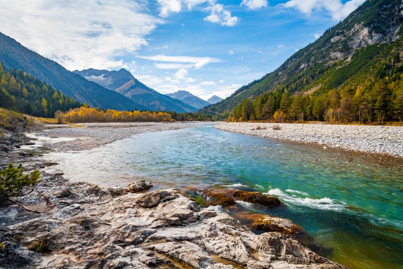
Austria's westernmost region feels distinctly different—more remote, less crowded, and genuinely wild. The Lech River carves through dramatic gorges and valleys, creating one of Europe's last free-flowing Alpine rivers. The Lechtal Alps offer moderate-altitude trekking (mostly 1,800-2,400m) with excellent trail infrastructure but far fewer hikers than Tyrol's popular routes. If you value solitude and pristine nature over technical challenge, Vorarlberg delivers.
Highlights:
Featured hike in this region:
Eastern Tyrol & Venediger Group
Often overlooked in favor of more famous regions, Eastern Tyrol offers exceptional remote trekking through the Venediger Group's glacier-dominated landscape. This is high-altitude wilderness hiking with fewer services and more self-sufficiency required, rewarding experienced mountain travelers with genuine solitude and some of Austria's most pristine alpine environments. The Alpe-Adria Trail also crosses this region, connecting Austria with Slovenia and Italy.
Highlights:
Featured hike in this region:
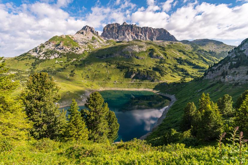
Salzburg Alps & Almenweg Region
The Salzburger Almenweg represents a different style of Austrian trekking—alpine pasture hopping at moderate elevations (1,500-2,200m) with exceptional mountain hut hospitality and gentler terrain than the high Alpine routes. This region emphasizes cultural immersion and traditional Alpine farming landscapes over technical challenge, making it ideal for hikers new to multi-day trekking or those seeking a more relaxed pace. The scenery remains spectacular despite lower elevations, with rolling ridges, flower-filled meadows, and panoramic views across the Salzburg Alps.
Highlights:
Featured trek in this region:
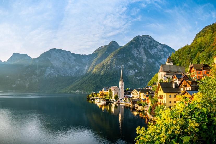
Salzkammergut & Lower Austria
Austria's lake district offers a completely different trekking experience—lower-elevation hiking (800-2,000m) combining Alpine scenery with pristine mountain lakes. The Salzkammergut region features gentler terrain, family-friendly trails, and the unique experience of trekking from lake to lake through forested mountains and traditional villages. This is ideal for hikers wanting Alpine beauty without high-altitude challenges, or for extending the hiking season (trails here are accessible May through October, longer than high Alpine routes).
For more detailed information about Austria's diverse hiking regions and their unique characteristics, explore our curated top 15 hiking landmarks in Austria guide.
Highlights:
Featured trek in this region:
Best Time for Hut-to-Hut Hiking in Austria
The Austrian hiking season runs from mid-June through mid-September, directly correlating with mountain hut opening schedules. Huts close their doors during winter and remain shuttered until snow conditions allow safe access and operation—typically late May or early June depending on elevation and snowpack.
While some lower-elevation lodges may open in May and remain operational into October, you shouldn't count on this availability when planning advance bookings for hut-to-hut treks. The reliable core season remains late June through early September.

Monthly Breakdown
Month | Conditions | Crowds | Best For |
Late May - Early June | Some huts still closed, possible snow on high passes, wildflowers emerging | Very few | Experienced hikers comfortable with variable conditions |
Mid-Late June | Nearly all huts open, trails clearing, peak wildflower bloom | Light-moderate | Wildflower enthusiasts, photographers, those seeking solitude |
July | All huts open, most stable weather, warmest temperatures | Moderate-heavy (increases after mid-month with school holidays) | First-time visitors, families, anyone prioritizing weather certainty |
August | Continued stable weather, very warm at altitude | Heaviest crowds of year | Social hikers, those with fixed August vacation schedules |
Early-Mid September | Crystal-clear air, stable weather, autumn colors beginning, cooler temperatures | Light-moderate | Photographers, experienced hikers seeking optimal conditions |
Late September | Some huts closing, shorter days, colder nights, first snow possible | Very light | Autumn color enthusiasts, solitude seekers |
Weather Patterns
Afternoon thunderstorms dominate the summer hiking season. During hot days from June through August, storms develop with remarkable regularity between 2-5 PM. Experienced Alpine hikers build their entire schedule around this pattern—start early (7-8 AM), reach your destination by early afternoon, and watch storms roll through from the safety of a mountain hut.

For comprehensive month-by-month guidance including detailed weather patterns, packing recommendations, and booking timelines, see our month-by-month weather guide.
Temperature variations by elevation are significant: expect approximately 6°C temperature drop for every 1,000m elevation gain. A comfortable 22°C valley morning translates to roughly 10°C at 2,500m on high passes—full layering systems remain essential even in August.
Booking Timeline
High season (July-August): Book mountain huts 3-5 months in advance—ideally by March or April for popular routes.
Shoulder season (June, September): Book 2-3 months ahead for most routes, though popular huts on signature trails like Stubai Höhenweg still fill up quickly.
Our strong recommendation: Target late June (final 10 days) or early September (first three weeks) for optimal conditions—excellent weather, manageable crowds, reasonable prices, and the full Alpine hiking experience.
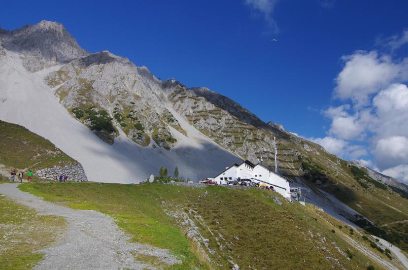
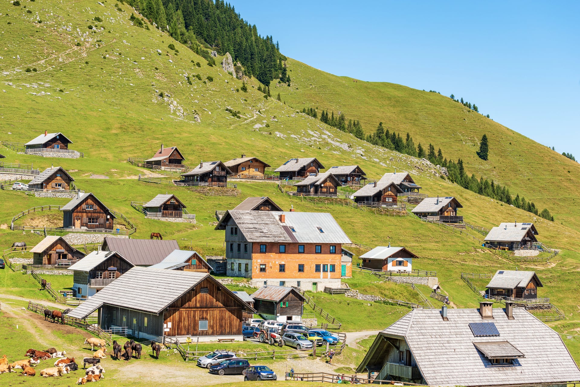
Understanding Austrian Mountain Huts
Mountain huts (Almhütten and Berghütten) form the backbone of Austria's trekking infrastructure, enabling multi-day Alpine journeys without carrying camping equipment. Most are managed by the Austrian Alpine Club (Österreichischer Alpenverein), the country's largest mountaineering organization, though private and other club huts also dot the landscape.
Understanding mountain hut culture, facilities, expectations, and etiquette helps you prepare mentally and logistically for the authentic hut-to-hut experience.
What Makes Austrian Hut Culture Special
Austrian mountain huts embody a uniquely Alpine tradition dating back over a century. Unlike commercial hotels, these are genuine mountain refuges positioned in spectacular high-altitude locations accessible only on foot, existing primarily to provide safe shelter for mountain travelers. The communal atmosphere—shared dining tables, group meals, dormitory sleeping—creates immediate camaraderie among hikers from diverse backgrounds.
The hut experience is authentically rustic by design. Logistics are complicated and expensive at 2,000-2,800m elevation where supply helicopters fly in provisions and solar panels provide limited electricity. You won't find luxury amenities, but you'll discover something more valuable: genuine mountain hospitality, spectacular positioning, and cultural immersion in Alpine traditions.
1. Accommodation Types
Dormitory rooms (Matratzenlager or Lager) are standard. You'll share sleeping quarters with 6-20+ other hikers on bunk beds with mattresses, blankets, and pillows provided. Most huts organize dormitories by gender when possible, though mixed dorms are common on busy nights.
Private rooms (Privatzimmer) with 2-4 beds exist in some huts, particularly larger or more accessible ones. These book out first—often months in advance—and cost 30-50% more than dormitory beds. Don't count on private room availability for last-minute bookings.
Pro tip: Sleeping bag liners are mandatory in all huts. This thin sheet liner prevents body contact with blankets and reduces laundry burden on huts. You must bring your own (lightweight silk or cotton liners weigh 200-300g) or purchase disposable versions on-site for €3-8. Huts will refuse accommodation without one!
2. Facilities & Services
Bathrooms are shared, typically with limited stalls relative to capacity. Expect morning queues. Water-saving toilets are standard.
Showers exist in most huts but come with significant caveats. Water supply is often rainwater-dependent, meaning showers may be unavailable during dry periods. When functional, showers cost around €3-5 for 3-4 minutes (purchase tokens at reception). Some hikers skip showers entirely on multi-day treks—it's socially acceptable.
Electricity is limited. Most huts have charging stations for phones and devices, but slots are limited and may cost €1-2. Bring portable battery packs for camera and phone charging independence.
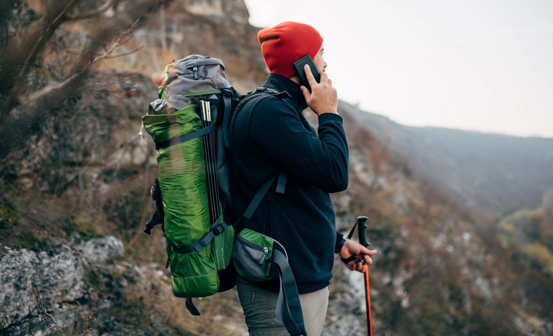
Mobile reception is inconsistent. Many high-altitude huts lack cell coverage entirely. Plan on being genuinely disconnected for portions of your trek—it's part of the experience.
WiFi is increasingly available in larger, more accessible huts, but don't count on it. When available, it's often slow and may require purchase codes.
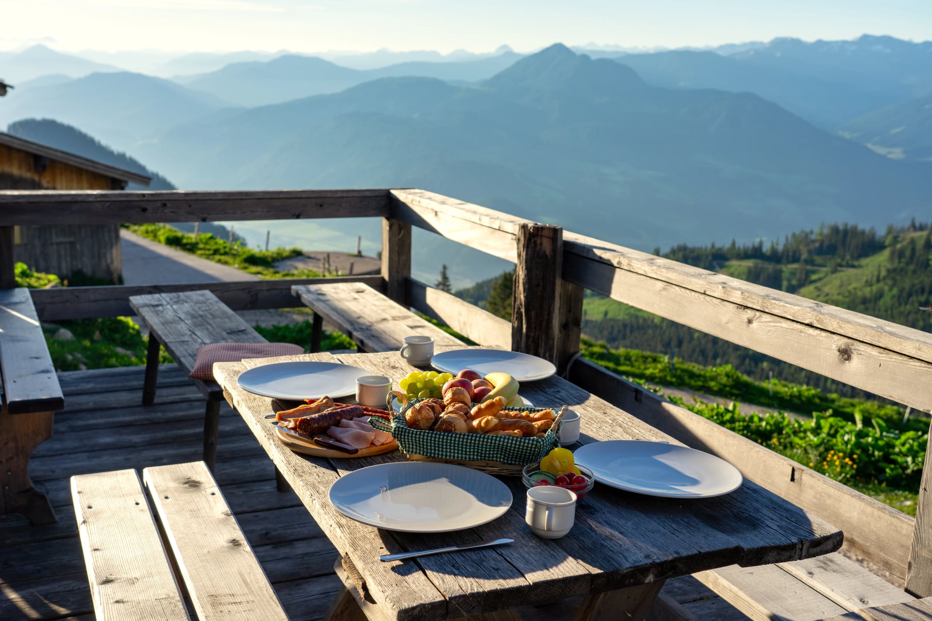
3. Food & Dining
Austrian huts operate on a half-board (Halbpension) system that's become the standard for hut-to-hut hiking. Half-board includes:
Dinner (Abendessen): Served 6-8 PM, typically a hearty traditional Austrian meal—soups, stews, schnitzels, goulash, dumplings, spätzle. Portions are generous. Most huts serve family-style at communal tables, creating social atmosphere.
Breakfast (Frühstück): Served 7-8 AM, a Continental spread of bread, cheese, cold cuts, jam, butter, coffee, and tea. Sufficient for starting your hiking day.
Lunch is not included in half-board. Most hikers carry trail snacks (bars, dried fruit, nuts) or order packed lunches from huts (€8-12, prepared the evening before). Some routes pass huts convenient for lunch stops.
Drinks are extra. Expect to pay €3-5 for beer, €2-3 for soft drinks, €1-2 for tap water. Huts encourage purchasing drinks rather than carrying heavy water bottles up mountains.
Dietary restrictions can usually be accommodated with advance notice (provided during booking). Vegetarian options are standard; vegan, gluten-free, and allergy accommodations require advance communication.
4. Austrian Hut Cuisine to Try
While menus vary by hut and region, certain traditional Austrian mountain dishes appear frequently and represent authentic Alpine cuisine worth experiencing.
5. Mountain Hut Etiquette
Remove hiking boots immediately upon entering. All huts provide dedicated boot rooms. Most supply crocs, flip-flops, or hut slippers to borrow, though bringing your own lightweight camp shoes (Crocs, sandals) weighs minimal.
Quiet hours (Ruhezeit) after 10 PM are strictly observed. Hikers wake early (6-7 AM) for early starts, meaning evening socializing ends promptly. Be considerate of dormitory mates.
Morning departures should be silent. Pack your backpack the evening before, organize gear outside the dormitory, and minimize noise when leaving before others wake.
Trash goes down with you. Huts cannot dispose of personal waste—carry all packaging, wrappers, and trash to valley towns with waste facilities.
Respect fellow hikers' space. Dormitories are tight quarters. Keep your belongings organized, don't spread gear everywhere, and be mindful of others.
For detailed information about specific huts in each region, including facilities, positioning, and what makes certain huts special, see our guide to the best huts to stay in when hiking in Austria.
6. Booking & Payment
Book as early as possible—hut-to-hut hiking's growing popularity means peak season (July-August) huts fill up 3-5 months in advance. Some popular huts on routes like Stubai Höhenweg sell out completely for peak weeks.
Booking methods vary by hut:
Online: Some huts use AlpenVerein booking system or individual websites
Email: Many smaller huts prefer email bookings
Phone: Traditional but requires German language skills
Payment is cash-only in most mountain huts. ATMs don't exist at 2,500m. Carry sufficient euros for your entire trek—budget €60-90 per day per person covering half-board (€45-65), drinks (€10-15), and incidentals (showers, charging, packed lunches).
Austrian Alpine Club membership offers significant advantages:
Discounted hut rates (typically 30-50% off standard prices)
Priority booking during high-demand periods
Mountain rescue insurance included with membership
Access to club-owned huts across the Alps
Discover the Alpine Club’s website for more information on the membership.

Why Book With Us
Booking Austrian mountain huts as a foreign visitor involves language barriers, scattered booking systems, uncertain availability, and time-consuming coordination across multiple huts for a single trek.
Our hut-to-hut hiking tours handle all accommodations, securing your beds months in advance, coordinating with hut keepers in German, and ensuring you have guaranteed lodging every night of your trek. We remove the logistical stress so you can focus on preparation and excitement.
How to Prepare for Austrian Hiking
Austrian Alpine hiking—especially multi-day hut-to-hut treks—demands physical fitness, appropriate gear, and mental preparation for sustained mountain travel. While most established trails avoid technical climbing, the cumulative challenge of average daily 12-18km stages with 800-1,200m elevation gains, often crossing passes above 2,500m, and carrying backpacks day after day requires genuine preparation.

Fitness & Training
If you're a regular hiker—hiking weekly or bi-weekly, comfortable with full-day outings, and familiar with multi-day trips—you have a solid foundation. If not, begin training at least 8-12 weeks before your trek.
Training progression:
12-8 weeks out: Start with weekly hikes on local terrain, even just modest hills. Focus on time on feet (2-3 hours minimum) rather than pace. Build base endurance.
8-4 weeks out: Increase to 2-3 hikes per week, including one longer weekend hike (4-6 hours) and shorter midweek sessions. Add elevation gain progressively—aim for 500-800m cumulative gain on weekend hikes. Begin carrying a weighted backpack (5-8kg) to simulate trekking conditions.
4-2 weeks out: Peak training volume. One weekly hike should mimic actual trek conditions: 12-15km distance, 800-1,000m elevation gain, 8-10kg backpack. Your legs, cardiovascular system, and feet should adapt to sustained effort at trekking pace.
2 weeks out: Taper training volume to allow recovery before departure. Maintain fitness with shorter hikes but reduce intensity and duration.
Fitness benchmarks to target:
Comfortably hike 12-15km with 800-1,000m elevation gain in 5-7 hours
Maintain sure-footedness on uneven, rocky terrain even when fatigued
Carry 8-10kg backpack without shoulder or back discomfort
Hike consecutive days without excessive muscle soreness
If you're interested in incorporating summit attempts into your trek, review our guide to the best peaks to visit when hiking in Austria for fitness requirements and technical considerations for Austria's most accessible Alpine summits.
Cardiovascular endurance matters more than strength. Alpine hiking is sustained aerobic effort at moderate intensity for 5-8 hours daily. Running, cycling, swimming, or stair climbing all build complementary fitness, but hiking itself is the best training.
Mental preparation is underestimated. Multi-day treks involve continuous physical effort, variable weather, dormitory sleeping with snoring, and moments of discomfort or fatigue. Mental resilience—staying positive, managing discomfort, enjoying the journey despite challenges—matters as much as physical fitness.
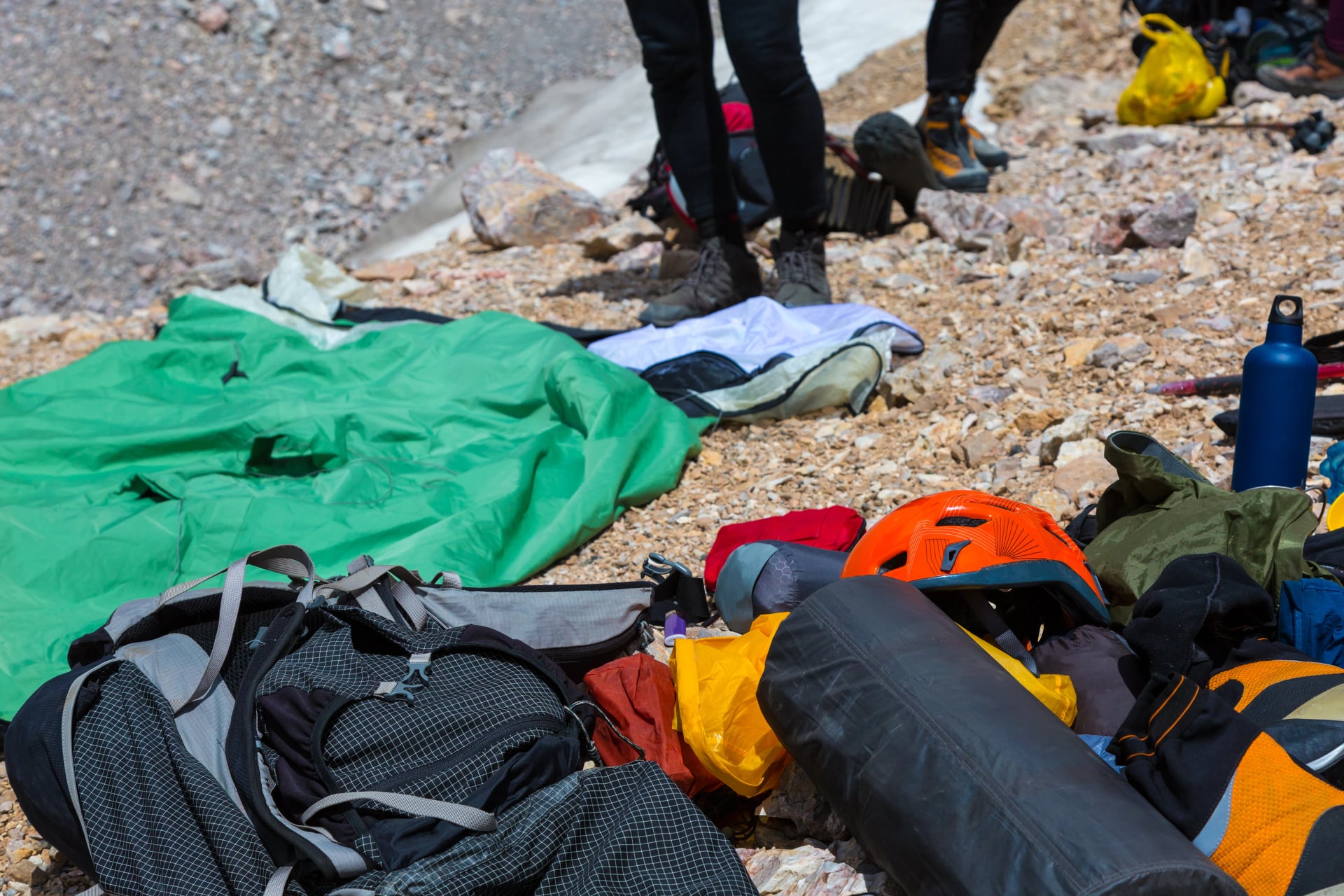
Gear & Packing
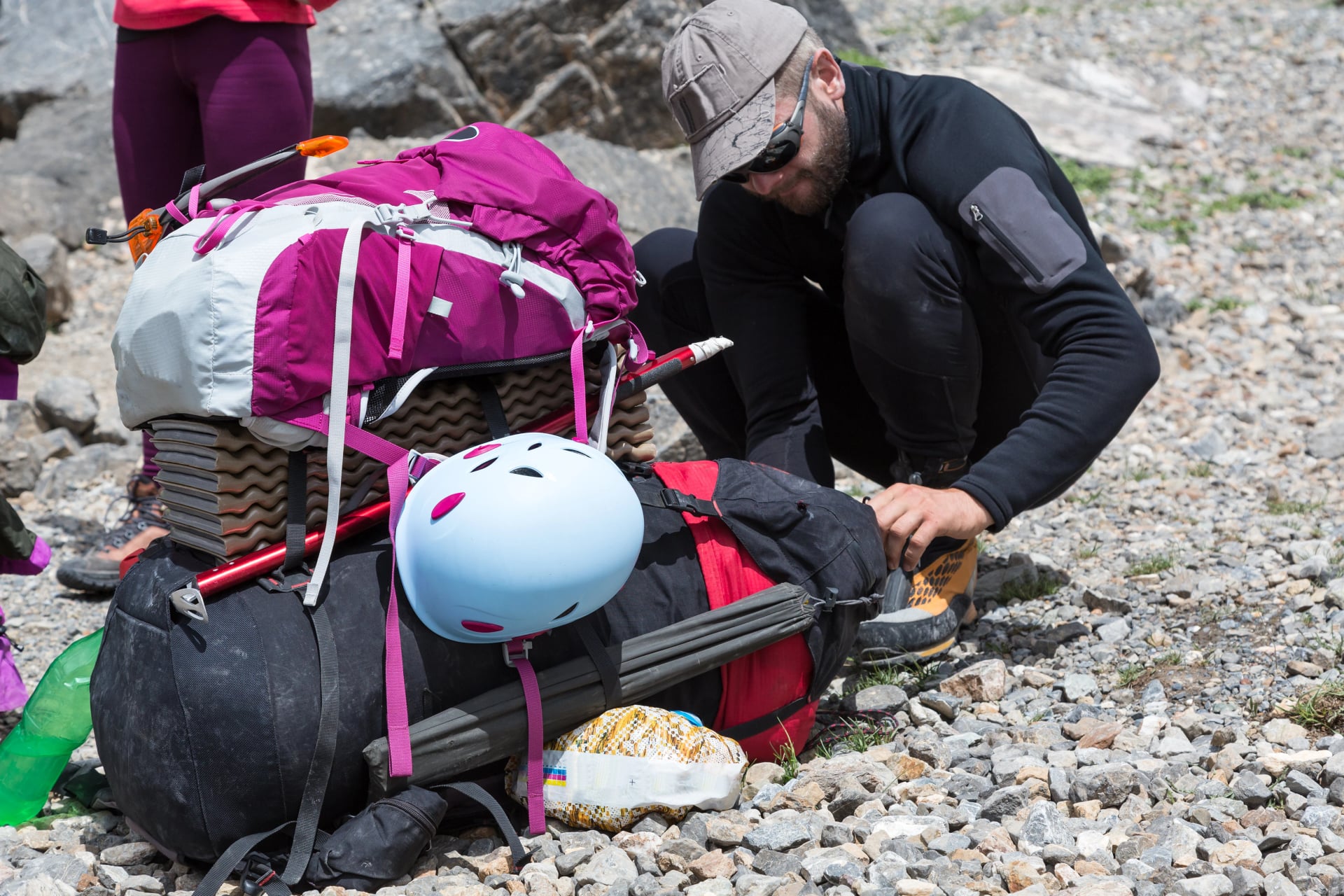
"If you want to know how experienced a mountaineer is, watch them pack their backpack." This Alpine saying holds truth: effective packing balances preparedness with weight discipline. Every unnecessary item adds burden over 50-100km of hiking.
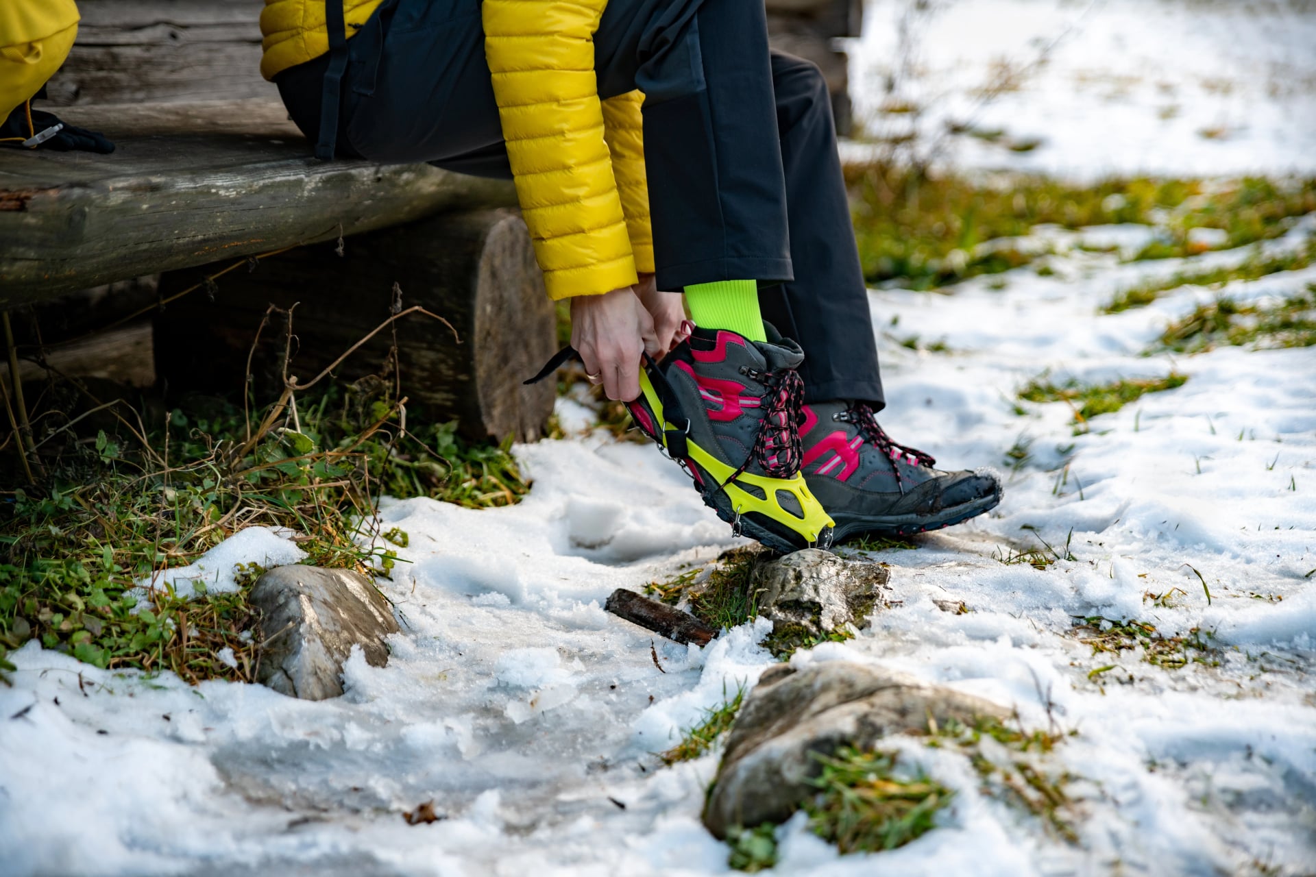
The most vital gear piece: hiking boots or shoes. Your feet carry you across Austria's Alps—invest in footwear that fits properly, supports your ankles under load, and won't cause blisters.
Trail running shoes work for experienced hikers accustomed to minimalist footwear and confident on technical terrain. For most hikers, proper hiking boots with ankle support remain the better choice, especially when carrying 8-12kg backpacks across rocky trails and scree slopes.
Break in your boots completely before your trek. Wear them on training hikes with weighted backpacks to identify pressure points, adjust lacing, and ensure they won't cause blisters over multi-day use.
Essential Packing List
Footwear & Accessories:
Hiking boots or shoes (broken in)
Camp shoes or sandals (for evenings in huts—Crocs work perfectly)
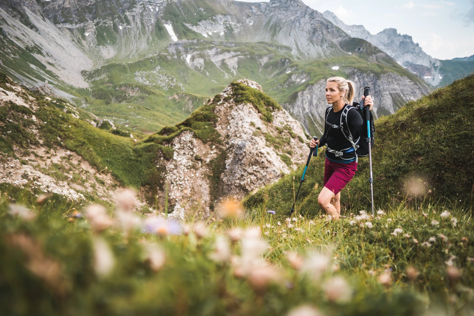
Hiking poles (essential for knee relief on descents and stability on uneven terrain)
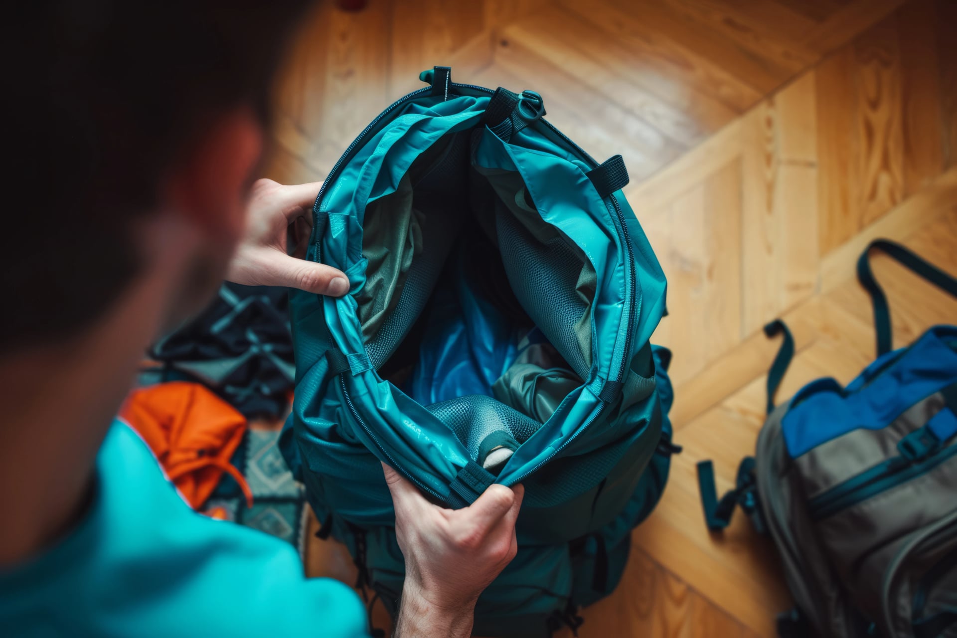
Backpack:
25-35 liter capacity for hut-to-hut treks (you're not carrying camping gear or cooking equipment)
Rain cover or waterproof liner
Target packed weight: 8-12kg maximum including water
Clothing - Layering System:
Base layer top: Merino wool or synthetic (never cotton—it holds moisture)
T-shirt or light top for warm valley hiking
Mid-layer insulation: Fleece or lightweight synthetic jacket
Down jacket or synthetic puffy for cold mornings, high passes, and hut evenings
Hardshell waterproof jacket: Quality matters—cheap rain jackets fail in Alpine storms
Waterproof pants: Essential for protection on exposed passes during storms
Hiking pants (zip-off convertible pants work well)
Hiking shorts for warm weather
Warm hat and gloves (yes, even in July—high passes get cold)
Sun hat or cap for valley hiking
3-4 pairs hiking socks (merino wool blend recommended)
Comfortable clothes for hut evenings (lightweight, quick-dry preferred)
Required Items:
Sleeping bag liner (Hüttenschlafsack): Mandatory in all huts
Sunglasses (high-altitude UV is intense)
Sunscreen SPF 30+ and lip balm
First aid kit: Blister plasters (Compeed), pain relievers, personal medications, bandages
Water bottles or hydration system (1.5-2L capacity)
Headlamp for early starts or evening hut use
Toiletries (travel-size, biodegradable soap preferred)
ID or passport
Cash (€60-90 per day minimum)
Phone with offline maps and emergency contacts
Optional But Recommended:
Portable battery pack (10,000mAh) for device charging
Camera
Trekking gaiters (for scree and snow patches)
Whistle (for emergency signaling)
Multi-tool or knife
Book or e-reader for hut downtime
What NOT to pack:
Camping gear (tent, sleeping bag, cooking equipment—unnecessary for hut-to-hut)
Multiple outfit changes (you'll repeat clothes—it's normal)
Heavy toiletries or full towels (huts provide towels when showers are available)
Excessive electronics
Anything "just in case" that you likely won't use
Top Multi-Day Hikes in Austria
Austria offers dozens of multi-day trekking routes, from 3-day introductions to 2-week epics crossing entire mountain ranges. The following five routes represent some of Austria's finest hut-to-hut experiences—each carefully chosen for spectacular scenery, achievable challenge, excellent infrastructure, and consistent hiker satisfaction.
These are routes we've guided, refined, and watched transform hikers year after year. They're not just popular trails—they're routes that deliver unforgettable Alpine experiences across difficulty levels.
For a curated overview comparing Austria's absolute best multi-day routes, see our Top 5 Treks in Austria guide.
1. Adlerweg Highlights
The Eagle's Path through the heart of the Karwendel Alps—Tyrol's most spectacular 5-day mountain traverse.
The Adlerweg spans all of Tyrol across 33 stages covering 413 kilometers total, its route tracing the shape of an eagle with outstretched wings across the map. But this 5-day highlights section captures the route's most spectacular segments in the Karwendel Alps without the month-long commitment, making it Austria's most accessible introduction to serious Alpine trekking.
What Makes it Special
You'll hike through the heart of Karwendel Nature Park, Austria's largest protected area, crossing dramatic limestone ridges with 360-degree Alpine panoramas. The route balances challenging mountain passes with comfortable valley sections, delivering varied terrain that keeps each day interesting. Lower technical demands than routes like Stubai make this achievable for fit hikers without extreme altitude experience, while the rich Tyrolean cultural element—traditional villages, mountain huts serving regional cuisine, centuries-old Alpine farming traditions—adds depth beyond pure scenery.
Key details:
Duration: 5 days
Distance: ~75km
Technical difficulty: 3/5 | Fitness level: 4/5
Cumulative elevation gain: ~5,000m
Highest point: ~2,400m
Best season: June through September
Highlights:
Best for: First-time Alpine trekkers wanting manageable introduction to hut-to-hut hiking, families with teenagers, hikers seeking varied scenery without extreme altitude challenges, anyone interested in Tyrolean cultural immersion alongside mountain beauty.
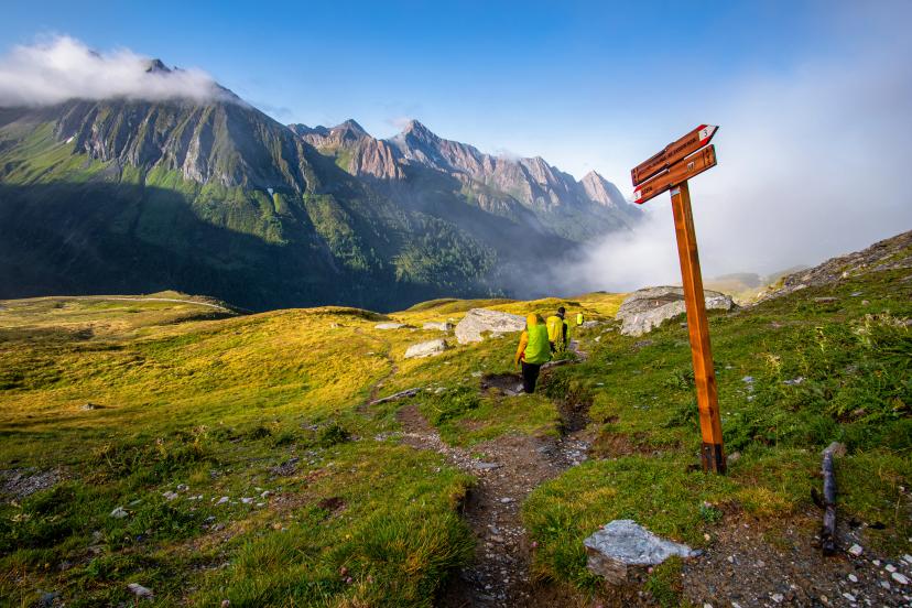
Navigation: The Adlerweg is exceptionally well-marked with eagle logos and standard red-white-red Austrian trail blazes. Information boards at stage starts and ends provide difficulty ratings, estimated times, and hut details. For comprehensive planning, see our dedicated Adlerweg hiking guide.
Experience the Eagle's Path:
2. Emperor's Crown Trail (Kaiserkrone)
A 7-day circuit around the Wilder Kaiser massif—Tyrol's most beloved mountain range and a perfect introduction to Austrian hut culture.
The Emperor's Crown Trail encircles the Wilder Kaiser massif in a complete loop, offering hikers the satisfaction of circumnavigating an entire mountain range while experiencing the full diversity of this legendary Tyrolean region. The trail earned its name from the crown-like profile of the Wilder Kaiser peaks visible from surrounding valleys—a distinctive silhouette that's defined Tyrol's landscape for centuries.
What Makes it Special
This route strikes an ideal balance between mountain challenge and accessibility. You'll cross high ridges with dramatic limestone wall views but avoid extremely exposed or technical terrain, making it achievable for intermediate hikers. The trail passes through active Alpine pastures (Almen) where cattle graze in summer, traditional farming huts serve fresh dairy products, and the landscape feels authentically Tyrolean. Dense beech, birch, and spruce forests alternate with open meadows and rocky ridgeline walking, creating scenic variety throughout the circuit.
The quality of mountain huts along the Emperor's Crown consistently ranks among Austria's best, with excellent food, comfortable accommodations, and spectacular positioning overlooking the Wilder Kaiser walls.
Key details:
Duration: 7 days (can be shortened to 5-6 days)
Distance: ~65km
Technical difficulty: 3/5 | Fitness level: 3/5
Cumulative elevation gain: ~5,500m
Highest point: ~2,200m
Best season: June through mid-October (longer season than high Alpine routes)
Highlights:
Best for: Intermediate hikers seeking a complete circuit experience, those new to multi-day hut-to-hut treks but with decent fitness, hikers who appreciate cultural elements and traditional Alpine farming landscapes, anyone wanting excellent hut food and comfortable accommodations.
Navigation: Red trail markers throughout, well-maintained paths with steep sections secured by cables where necessary. The complete loop nature of the trail makes navigation straightforward—you're always circling the Wilder Kaiser massif with recognizable landmarks.
Circle the Emperor's Crown With Us:
3. 3-Day Hohe Tauern Hut-to-Hut Hike
The perfect introduction to Austrian Alpine trekking—three days of spectacular Hohe Tauern scenery without the week-long commitment.
For hikers new to hut-to-hut trekking, those with limited vacation time, or anyone wanting to test Alpine hiking before committing to longer routes, this 3-day Hohe Tauern sampler delivers authentic mountain experiences in a condensed, accessible format. You'll hike through Austria's largest national park, sleep in mountain huts at spectacular high-altitude locations, and experience the rhythm of hut-to-hut travel—all in a long weekend.
What Makes it Special
Lower technical demands make this genuinely accessible to fit hikers without extensive mountain experience. You'll cross moderate passes around 2,400m with excellent trail infrastructure, experiencing high Alpine scenery without extreme exposure or difficult terrain. The concentrated intensity—three straight days of mountain immersion—creates surprising impact despite the short duration. You'll cover enough ground to feel genuine accomplishment while staying within realistic fitness requirements for most active people.
As a budget-friendly introduction to Austrian Alpine hiking, the 3-day format requires less vacation time and financial investment than week-long treks, making it ideal for testing whether hut-to-hut hiking appeals to you before booking longer adventures.
Key details:
Duration: 3 days
Distance: ~35km
Technical difficulty: 3/5 | Fitness level: 2/5
Cumulative elevation gain: ~2,500m
Highest point: ~2,400m
Best season: Late June through September
Highlights:
Best for: First-time hut-to-hut hikers testing Alpine trekking, weekend warriors with limited vacation time, those wanting to experience Austria's highest mountains without week-long commitment, hikers building confidence before tackling longer routes, anyone seeking budget-friendly Alpine introduction.
Navigation: Well-marked national park trails with standard Austrian red-white-red blazes. The short route and concentrated area make navigation straightforward even for those new to Alpine hiking.
Start your Alpine journey:
4. The Nockberge Trail
Ten days traversing the Nockberge Biosphere Reserve—Austria's most distinctive landscape of rounded green peaks and gentle Alpine pastures.

The Nockberge (Nock Mountains) represent something completely different from Austria's dramatic limestone peaks and glaciated high Alps. These ancient, rounded mountains—geological remnants of much older rock—create a landscape of rolling green summits, flower-filled meadows, and gentle ridgeline walking at moderate elevations (1,800-2,400m). The entire region is a UNESCO Biosphere Reserve, protecting unique Alpine ecosystems and traditional farming practices.
What makes it special:
This is high-level ridge walking at its finest—you'll spend days traversing above treeline on broad, grassy ridges with 360-degree panoramic views extending for miles in every direction. Unlike the rocky, technical terrain of routes like Stubai, the Nockberge offers comfortable walking on soft surfaces with minimal exposure, creating a more relaxed hiking rhythm. The distinctive rounded peak shapes (Nocken) give the range its name and character—these aren't jagged Alpine spires but flowing, organic mountain forms.
The cultural element is particularly strong here—you'll pass traditional Alpine farms (Almen) where cheese-making continues using centuries-old methods, experience Carinthian hospitality known for warmth and generosity, and witness landscapes shaped by sustainable Alpine farming.
Key details:
Duration: 10 days
Distance: ~125km
Technical difficulty: 4/5 | Fitness level: 4/5
Cumulative elevation gain: ~6,500m
Highest point: ~2,441m (Eisenhut)
Best season: June through late September
Highlights on the way:
Best for: Experienced hikers wanting extended ridge walking without technical challenges, those who appreciate Alpine farming culture and traditional landscapes, hikers seeking gentler terrain at sustained moderate altitude, anyone interested in UNESCO Biosphere Reserve ecosystems, photographers loving rolling green mountain scenery.
Navigation: Well-marked trail with consistent signage throughout. The ridge-walking nature of the route makes navigation generally straightforward with clear landmark visibility.
Discover the gentle giants:
5. The Dachstein Circuit
Ten days circumnavigating the Dachstein massif—Austria's most impressive northern limestone mountain and a journey through stunning karst landscapes.

The Dachstein massif at 2,995 meters forms the highest mountain in the Northern Limestone Alps, its distinctive white rock faces, extensive cave systems, and the region's only glacier creating dramatic scenery that feels distinctly different from the Central Alps' crystalline rock. This 10-day circuit completely encircles the massif, crossing high passes, traversing limestone plateaus, descending into green valleys, and offering constantly changing perspectives of the Dachstein's imposing walls.
What makes it special:
You'll experience the full spectrum of Northern Limestone Alps landscapes—stark white rock faces rising abruptly from green valleys, high karst plateaus with sinkholes and limestone pavements, deep caves and gorges, traditional Alpine villages, and the surreal experience of standing on Dachstein Glacier reached by cable car. The cultural diversity adds richness—you'll pass through regions influenced by Salzburg, Styria, and Upper Austria, each with distinct architectural styles, dialects, and food traditions.
Key details:
Duration: 10 days
Distance: ~140km
Technical difficulty: 4/5 | Fitness level: 3/5
Cumulative elevation gain: ~7,500m
Highest point: ~2,700m
Best season: Late June through mid-September
Highlights on the way:
Best for: Experienced hikers seeking a complete mountain range circumnavigation, those interested in limestone geology and karst landscapes, hikers who appreciate combining wilderness sections with valley culture, anyone wanting to experience the distinctive Northern Limestone Alps character, photographers drawn to dramatic white rock scenery.
Circle the limestone giant:
Getting to Austria's Hiking Regions
Austria's Alpine regions are remarkably accessible thanks to efficient public transportation connecting major airports to mountain valleys.
Located directly in the Alps, this is the primary gateway for Tyrol, Ötztal Alps, Stubai Alps, and Karwendel regions.
Regional buses connect directly to Stubai Valley (40 minutes) and Ötztal (90 minutes)
Airport sits just 15 minutes from Innsbruck's main train station
Onward train connections reach all Tyrolean valleys and mountain areas
Direct bus routes serve popular trailheads throughout the region
Though in Germany, Munich often provides better international flight options and excellent access to Tyrol and Bavarian Alps.
Direct trains to Innsbruck (2 hours) with connections to all Tyrolean valleys
S-Bahn connects airport to Munich main station (45 minutes)
Frequent departures throughout the day to Austrian destinations
Often cheaper flights than Innsbruck with better international connections
Ideal for Hohe Tauern National Park, Salzburger Almenweg region, and Salzkammergut.
Airport buses to Salzburg main station (20 minutes)
ÖBB trains and regional Postbus services reach mountain valleys within 1-2 hours
Direct buses serve Zell am See, Badgastein, and Salzkammergut lakes
Excellent connections to southern Austrian Alpine regions
Austria's largest international hub serves as the gateway to Salzkammergut, Lower Austria, and eastern mountain regions.
City Airport Train (CAT) or S-Bahn to Vienna main station (16-25 minutes)
Frequent trains to Salzburg (2.5 hours) with Alpine connections
Best option for combining Vienna city tourism with mountain hiking
Widest range of international flight options
For Vorarlberg and Lechtal Alps, Zürich provides convenient access from Switzerland.
Trains to Austria via Feldkirch and Bludenz (2-3 hours to Lech Valley)
Alternative routes through Innsbruck for eastern Vorarlberg approaches
Swiss rail efficiency makes connections reliable and comfortable
Good option for combining Swiss and Austrian Alps
Within Austria, the ÖBB rail network and regional Postbus system reach remarkably far into mountain valleys—many trailheads are directly accessible by public transport, eliminating rental car needs. Most of our tours include detailed transfer instructions from airports to your starting trailhead, and we can arrange private transfers when public transport schedules don't align with arrival times.

Why Us?
DIY vs. Guided Options
Self-guided trekking offers more flexibility—start when you want, hike at your own pace, adjust pace and itinerary based on weather, energy levels and recommendations from our team. We handle all logistics: hut bookings, route planning, navigation, problem-solving if issues arise.
Guided or organized tours remove logistical burden—accommodations pre-booked, detailed route information provided, GPX routes supplied, 24/7 support available if needed. You focus entirely on hiking and enjoying the mountains while we handle everything else.
What We Handle for You
When you book one of our self-guided hut-to-hut tours, you receive:
All mountain hut accommodations pre-booked (half-board where available)
Detailed day-by-day itinerary with route descriptions, distances, elevation profiles
GPS tracks for your device or smartphone
Route notes highlighting trail conditions, water sources, optional detours
24/7 emergency support throughout your trek
Luggage transfer on select routes where available
Pre-trip consultation to ensure the route matches your fitness and experience
You get the independence of self-guided hiking combined with the security of professional organization.
Ready for the Austrian Alps?
Austria's mountains offer some of Europe's finest hut-to-hut hiking—spectacular Alpine scenery, authentic mountain hut culture, well-maintained trails, and routes for every experience level from 3-day introductions to 2-week epics.
Whether you're taking your first steps into multi-day Alpine trekking or seeking your next challenging mountain adventure, Austria's huts are waiting with warm meals, comfortable beds, and that incomparable atmosphere of shared mountain experience.
Browse all Austria hiking tours to explore our complete collection of guided and self-guided treks across Austria's diverse mountain regions.
Get in touch to discuss which route suits your fitness, experience level, and mountain dreams—we'll help you plan the perfect Austrian Alpine adventure.
The mountains are calling. Time to answer.

.svg)
VALUE YOUR TIME
With everything on your plate, let us handle the vacation planning, so your valuable time stays exactly where you need it.
.svg)
TRIED & TESTED ADVENTURES
Only the best hut to hut hikes of Austria, cherry-picked by our local team with an in-depth knowledge of the region.
TRUSTED BY MANY
We are a financially protected company operating since 2014, and with thousands of satisfied customers in the past, we still put you first.

SELF-GUIDED TRAVEL
Explore independently and with confidence while we keep everything running from behind the scenes.
.svg)
OUTDOOR SPECIALISTS
We are a team of outdoor specialists equipped with the knowledge and insight to bring you the best hiking experiences.