Emperor’s Crown Trail
Traverse the majestic Wilder Kaiser range, a hiker’s paradise
Conquer panoramic summits, each offering a unique vista of the Austrian Alps
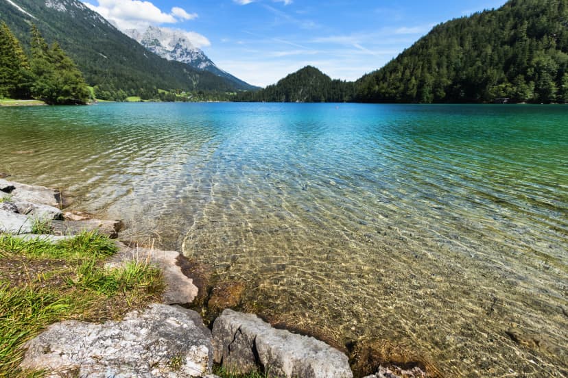
Unwind by the serene Hintersteiner See after a day of hiking
Savor authentic alpine cuisine in traditional mountain huts
Experience the thrill of a well-earned sunset in a mountain setting every evening
Navigate with ease with our detailed itineraries and user-friendly GPS app
Itinerary
Your journey begins with your arrival in Going, a serene and authentic village at the foot of the Wilder Kaiser range. This special place radiates calm and tranquillity, offering a unique landscape featuring rugged cliffs, meadows, and dense forests. Spend your day exploring the idyllic village, taking in panoramic views of the Wilder Kaiser mountain range, and experiencing the living craftsmanship and tradition. Enjoy the evening in one of the local inns, preparing for the hiking adventure that awaits.
Hotel or B&B in Going
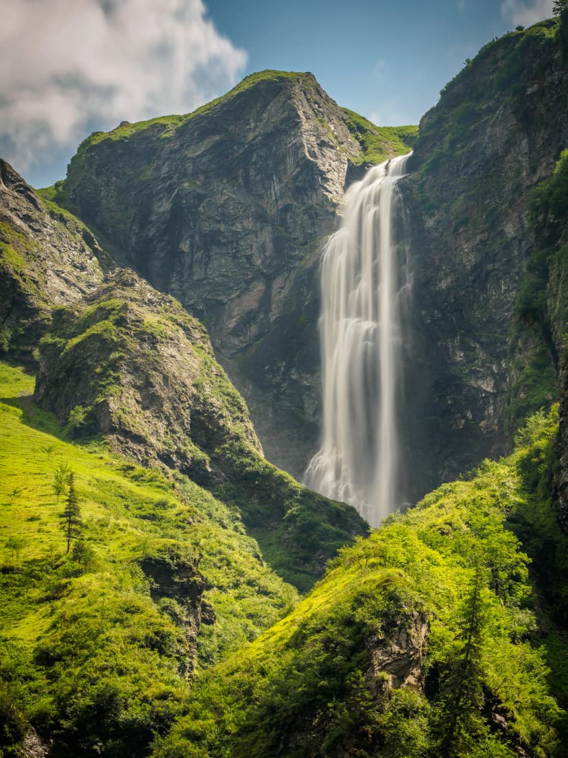
You’ll catch a free hiking bus to the starting point of your hike, Hüttling. From there, the trail leads you through the forest, past the enchanting Stiegenbach Waterfall, and up to the Obere Regalm, a spot known for its homemade regional delicacies. You’ll continue uphill to the Baumgartenköpfl and be rewarded with panoramic views of the Wilder Kaiser in the north and the Kitzbühel Alps and Hohe Tauern mountain range in the south.
Here, the trail descends to the Gaudeamushütte mountain hut and then leads towards Gruttenhütte via Klamml, a steep yet fascinating path secured with a ladder and several iron clamps. The day ends at the Gruttenhütte, the highest mountain hut in the Wilder Kaiser region, offering a beautiful sun terrace and a view of the Ellmauer Halt, the highest summit at 2,344 meters.
8 km and 1250 m elevation gain / 300 m elevation loss
Gruttenhütte
Disclaimer: Gruttenhütte cannot be paid in advance, meaning you’ll have to pay for it on the spot. This is already reflected in the price of our tour.
You’ll depart from the Gruttenhütte toward the west, soon joining the Wilder-Kaiser-Steig trail beneath the Kaiserkopf mountain. As you traverse beneath the Treffauer and Tuxeck summits, you’ll pass through aromatic mountain pines and forests. The Kaiser-Hochalm Alpine pasture offers a picturesque photo opportunity. You’ll continue on the trail to the Steiner-Hochalm mountain hut (note: only drinks are served here). The trail then traverses the slopes above the crystal-clear Hintersteiner See.
On this path, you’ll reach Walleralm, an Alpine hamlet at the foot of the Zettenkaiserkopf mountain. After a refreshing stop, you’ll continue across the Alpine meadows and through the forest to the cross on Hochegg mountain. From there, you’ll hike slightly downhill across gentle Alpine pastures to the cozy Kaindlhütte mountain hut at the Steinbergalm.
13.8 km and 810 m elevation gain / 1150 m elevation loss
Kaindlhütte
You’ll wake up to the beautiful setting of a green mountain pasture on a bright summer morning. The trail will then lead you past the Talofenschlucht gorge and the north face of the Hackenköpfe mountains before reaching the Anton-Karg-Haus mountain hut. After hiking through the forest and over serpentines, you’ll get to the Stripsenjochhaus mountain hut to settle in for the night.
9.3 km and 870 m elevation gain / 590 m elevation loss
Stripsenjochhaus
From the hut, you’ll traverse a scenic ridge blanketed with mountain pines, heading towards the Feldberg summit. On your journey along it, you’ll pass the Frankenländer Nadel formation and ascend to the aforementioned mountain peak.
From here, you’ll descend through the picturesque Obere Scheibenbichlalm Alpine pasture into the serene Kaiserbachtal Valley nature reserve. After reaching the valley, you’ll follow the trail east toward Griesenau. The final stretch of the trail leads through a beautiful forest, ending your day in the charming village of Gasteig.
16.5 km and 650 m elevation gain / 1500 m elevation loss
Hotel or B&B in Gasteig
Starting in Gasteig, you’ll hike through the woods along the forest road, passing the Rodelhütte mountain hut, and the Bacheralm refreshment stop. After traversing a passage secured with steel rope, you’ll reach the Ursulablick viewpoint, offering a view over the Kitzbühel Alps and the Maukspitze summit.
The trail continues along a wonderfully soft forest floor on the way to a gentle Alpine pasture landscape. You’ll pass the Graspoint-Hochalm. The day ends as you descend into the valley, returning to the starting point in Going. As the sun sets, enjoy one last evening in the tranquil village before departing for the airport the next day.
11.5 km and 950 m elevation gain / 800 m elevation loss
Hotel or B&B in Going
After completing the hike, you’ll return to Going for a well-deserved rest. Take this day to relax and reflect on your journey. Perhaps visit the Going bathing lake or explore the varied activities and excursion destinations in the area.
Pricing
Included in price
5x accommodations with breakfast
Tour design and organization
Booklet with detailed itinerary and route instructions
Service and support during your hike
GPS navigation with an easy-to-use app
Accommodation at Gruttenhütte (must be paid on the spot)
What to bring to the tour
Description
Embark on an unforgettable journey through the heart of the Austrian Alps with the Emperor’s Crown hiking trail that will immerse you in the breathtaking beauty of the Wilder Kaiser range, offering a unique blend of rugged mountain landscapes, serene alpine meadows, and crystal-clear mountain lakes.
The Emperor’s Crown (or Kaiserkrone) trail is a 65-kilometer route that winds through the stunning Wilder Kaiser mountain range. It offers a diverse hiking experience, with highlights including the enchanting Hintersteiner Lake, the panoramic views from the Stripsenkopf and Feldberg summits, and the tranquil Kaiserbachtal valley.
The Kaiserkrone trail demands about 5-7 hours of daily hiking across five days. Each day, you’ll cover between 8 and 16 kilometers, with a total elevation gain of around 5,000 meters. The route is well-marked and not technically demanding, but it does require a certain level of physical fitness.
At Hut to Hut Hiking Austria, we take care of all the logistics so you can focus on enjoying your hike. We oversee hut availability and handle all bookings, equip you with a detailed written handout, and offer GPS navigation through a user-friendly app.
We also provide local recommendations and are on hand to solve any issues which may arise. Additionally, we strive to put together the best possible experience for you, giving you a day in Going to prepare for your hike and a day after to reset after strenuous five days.
Ready to conquer the Emperor’s Crown and claim the Austrian Alps as your kingdom? No royal duties required — just a love for adventure and a thirst for breathtaking views! Let us handle everything while you focus on the journey. After all, every emperor deserves their own dedicated support team!
Map
Things to know
The hiking season usually lasts from mid-June to late September. It depends on the snow conditions in the higher sections of the Alps, as lots of hiking routes go over high mountain passes. You should check the current situation if you are visiting in early summer, especially for Stubai High Trail, as large parts of the route run above 2000 meters of elevation.
The huts close their doors once the season ends as well, so you cannot plan any multi-day tours outside this time window.
Read more about the hiking season in Austria here.
We’ve rated our tours on a difficulty scale from 1 to 5 — with 1 being the easiest and 5 the most difficult.
The difficulty level of a tour tells you how fit you need to be and how much hiking is involved. Most of our tours are appropriate for people who are regularly active and can hike for about five to seven hours per day.
Technical difficulty means how skilled you need to be to hike on the path. Level 1 means the trail is smooth and wide (like a gravel road), while 5 means the surface is uneven and exposed, and you have to use your hands to help yourself move forward. In practice, that means that the higher the level, the more surefooted and skilled in scrambling you need to be.
You should book your tour as soon as possible, as many accommodations along the trail fill up quickly. That way, you can ensure that you have a place to stay.
In case of an injury, it is best to call the local emergency services. You might find yourself in the wilderness, unable to continue without worsening your situation.
Do not worry too much, though. You will be hiking along popular trails, so you will not get stranded even if something happens.
On the other hand, if you feel too tired to continue hiking, you can always stop in any of the towns and villages along the way and use public transport to get to where you want to be in Austria.
Most huts along our hut-to-hut hikes are equipped with showers, but they might be a matter of whether there has been any rainfall lately. Do not expect too much, as mountain huts are not luxurious hotels.
Read more about the mountain huts here.
No. The huts provide blankets and pillows for comfort. However, you should bring your sleeping liner so they will not have to wash their bed linen every day.
Cell reception is unreliable in the mountains. If you can see a town, you will likely have a reception. The same goes for mountain huts. If you cannot get it inside, try stepping outside. Wifi is available only at select lodges; most do not have it.
If you dress appropriately, most stages can be done even in light rain. However, if a storm is forecasted, do not hike. In that case, you should wait until the storm passes, even if that means spending a day at the hut.
If you’d like to eat a vegetarian meal, it’s usually available at most accommodations. Vegan options are harder to find in huts, but we’ll let you know about them in advance so you can plan accordingly.
We do not demand that you have insurance before booking, but it is advisable to do. Joining the Austrian Alpine Club gets you covered in case anything unexpected happens to you on your way.