Adlerweg Ultimate Guide: Stages, Huts & Routes
A complete guide to the Adlerweg hiking trail, with stage breakdowns, terrain, elevation, huts, and best time to hike.
Quick links
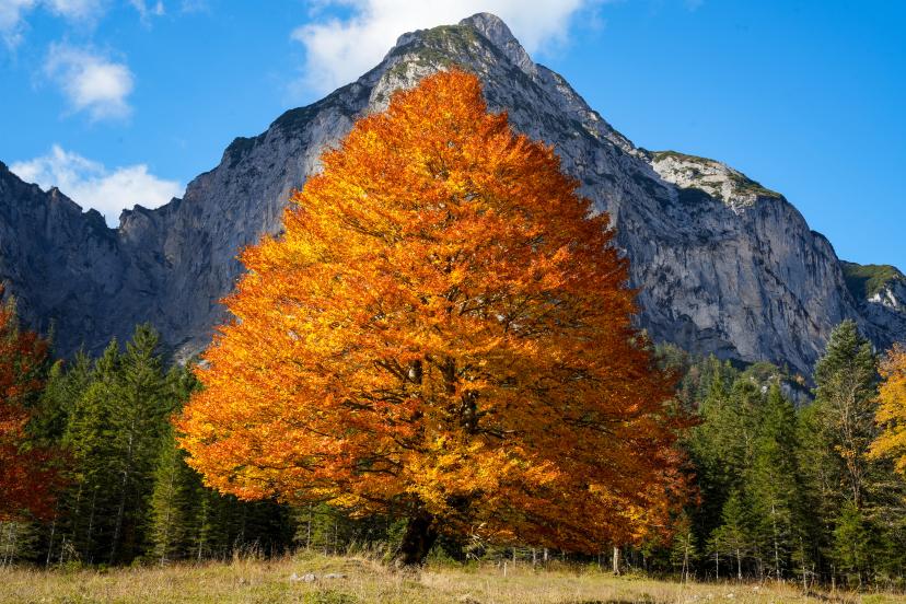
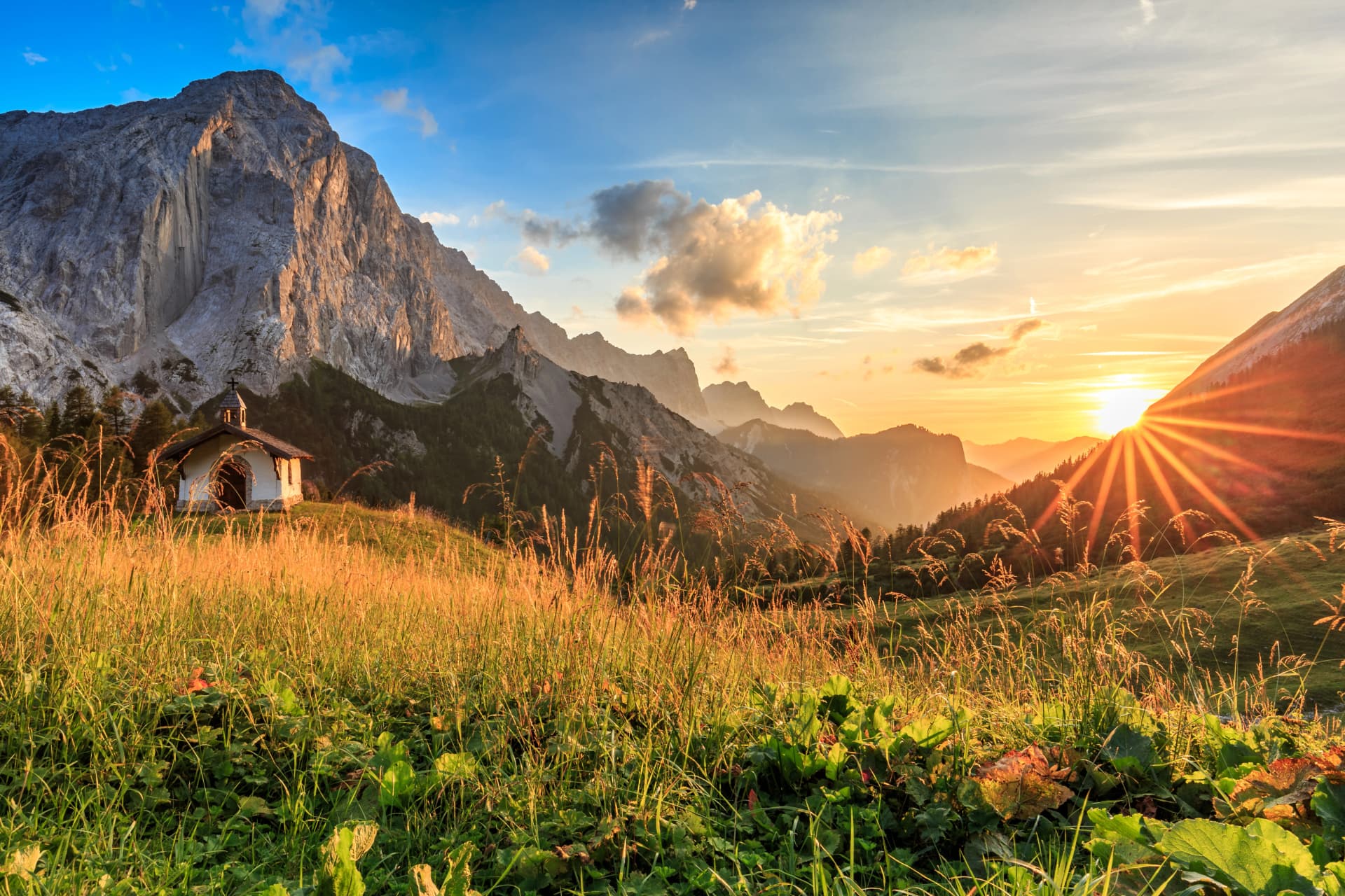
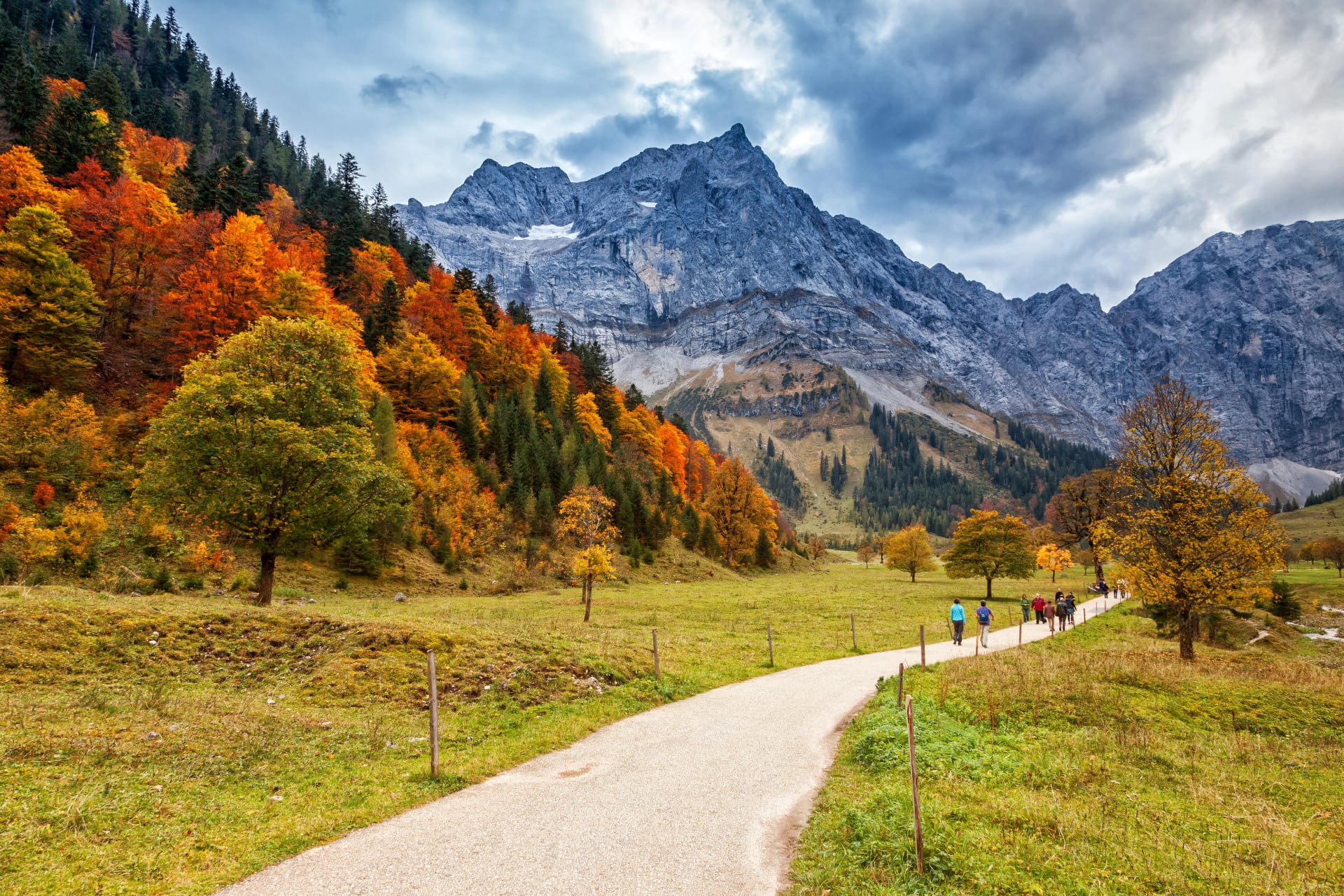
Did you know the Adlerweg spans 413 kilometers across all of Tyrol, crossing seven mountain ranges in the shape of an eagle spreading its wings across the map? This makes it Austria's longest marked hiking trail and one of the Alps' most diverse long-distance routes, combining accessible valleys with serious Alpine terrain.
The route traverses Tyrol from east to west (Northern section) plus a technical eastern extension through the High Tauern, linking the Kitzbühel Alps, Karwendel Nature Park, Wetterstein range, Lechtal Alps, and Venediger Group on a single continuous path marked with distinctive yellow eagle logos.
This guide provides everything you need before stepping onto the trail:
And much more…
Use this as your starting point for planning a safe, well-prepared, and unforgettable Adlerweg trek.
Quick Facts
Full Route:
Total distance: 413 km
Stages: 33 (24 Northern + 9 Eastern)
Duration: 24-33 days for complete route
Total elevation: ~31,000m gain/loss
Highest point: ~2,800m (various Karwendel and Stubai passes)
Adlerweg Highlights (Most Popular):
Distance: ~75 km
Stages: 5 days
Duration: 5 hiking days + arrival/departure
Total elevation: ~5,000m gain/loss
Highest point: 2,080m (Lafatscher Joch)
Difficulty rating: Moderate to challenging
Best season: June through September
Technical level: 3/5
Fitness level: 4/5
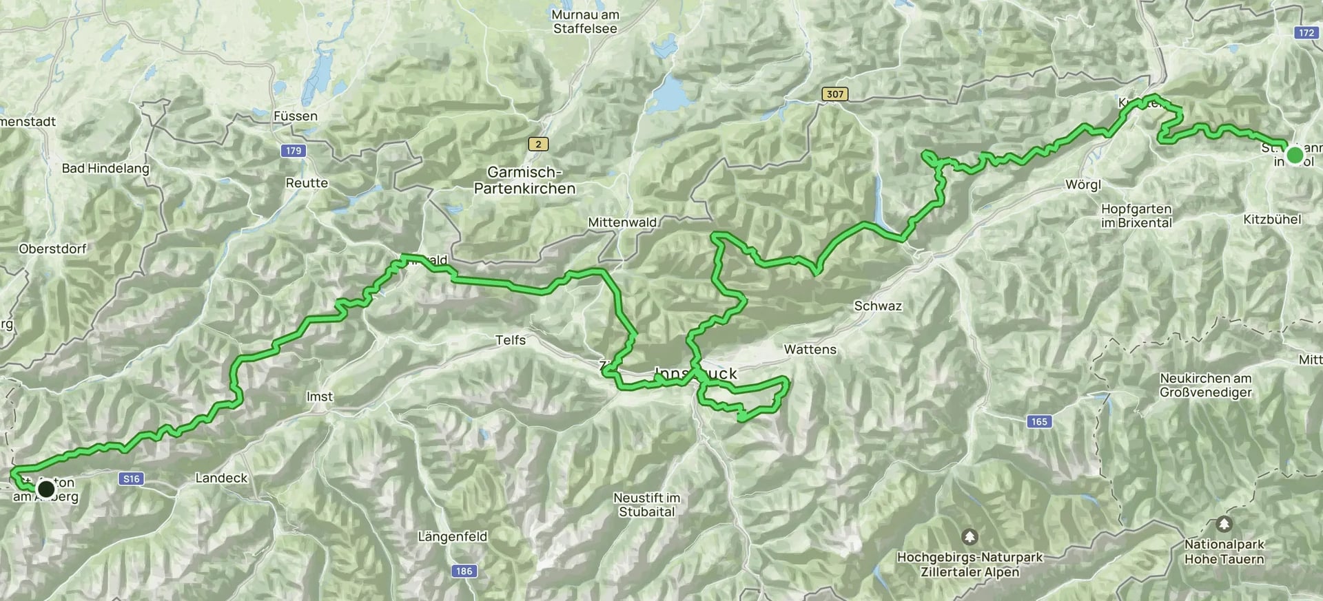
Adlerweg Map
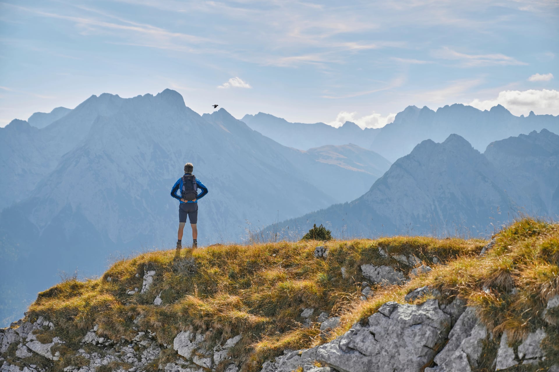
Why Hike the Adlerweg?
The Adlerweg is Tyrol's signature long-distance route, tracing the silhouette of an eagle—Tyrol's heraldic symbol—across Austria's most dramatic Alpine landscapes.
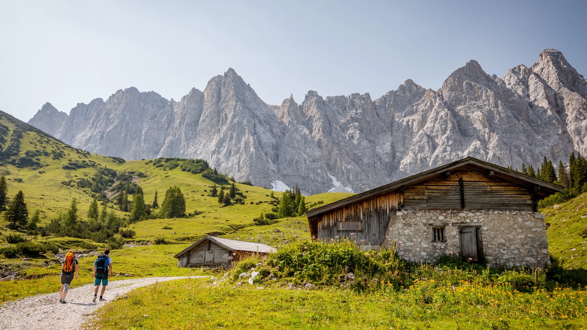
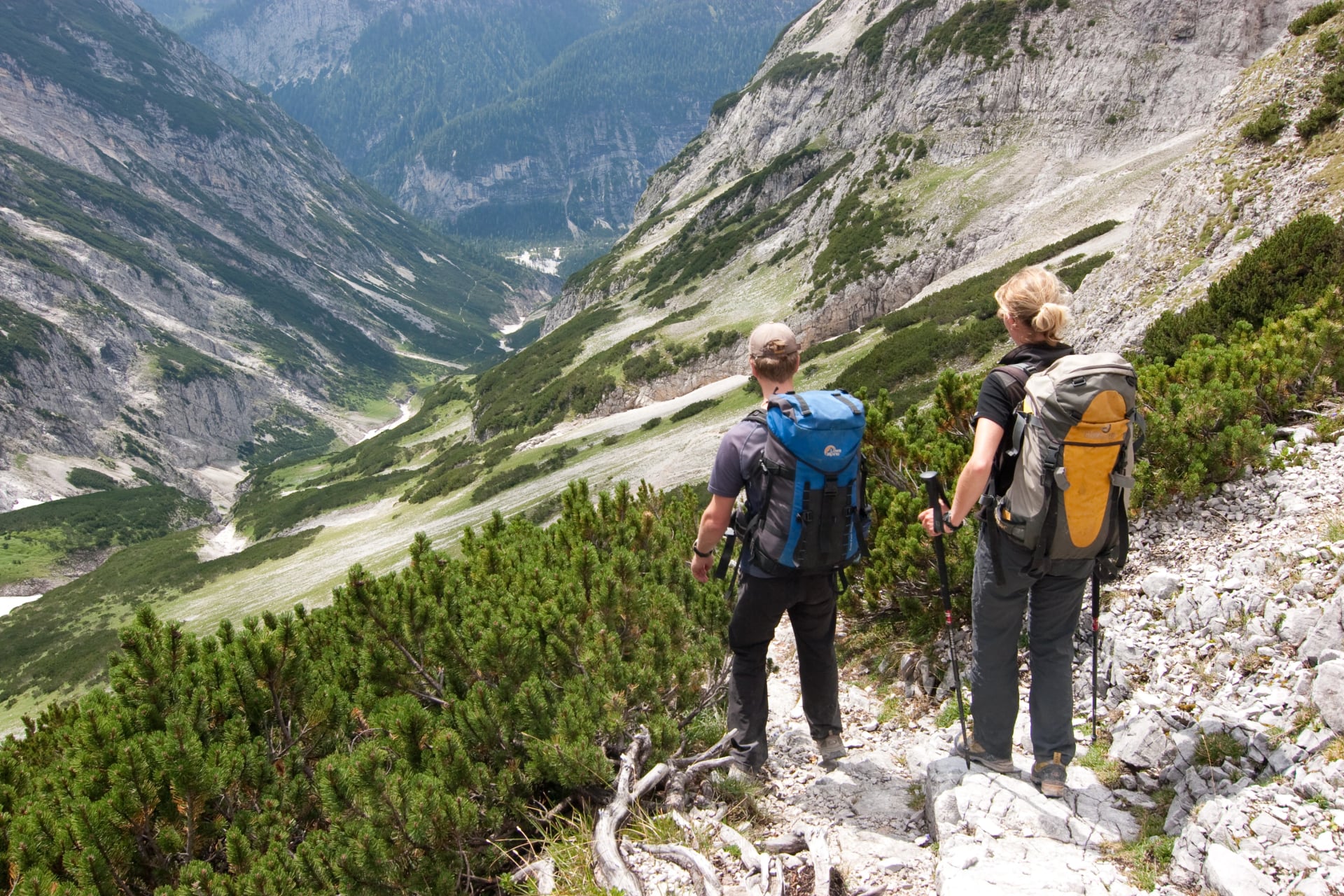
The terrain varies dramatically. You'll encounter Karwendel limestone ridges with dramatic exposure, Kitzbühel Alps rolling meadows, Wetterstein approaches near Zugspitze, and remote Lechtal wilderness. This diversity appeals to hikers wanting varied experiences—some stages feel like pleasant valley walks while others demand serious Alpine fitness.
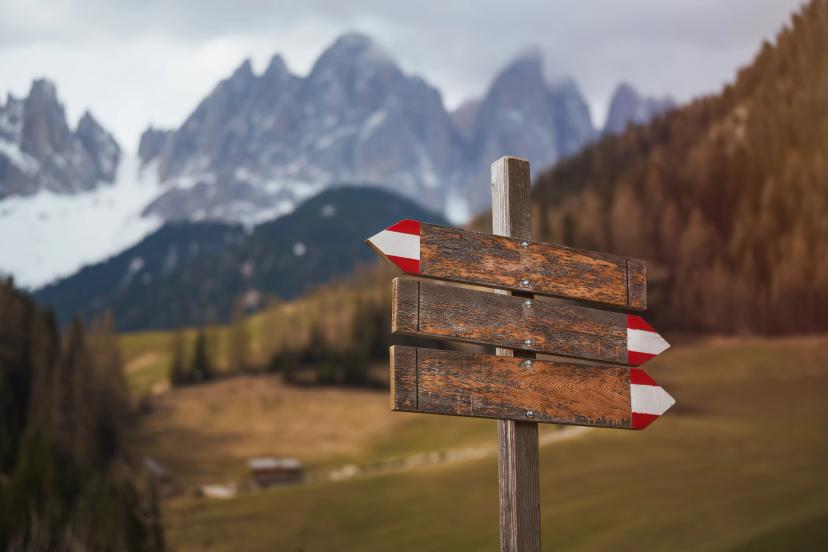
The route is exceptionally well-marked with yellow eagle logos and standard red-white-red trail blazes. Mountain hut infrastructure is excellent, with accommodation every 6-8 hours offering half-board and warm Tyrolean hospitality.
Most hikers tackle the 5-day Adlerweg Highlights through the Karwendel rather than the complete 33-stage traverse, capturing the route's best scenery without month-long commitment.
Best for: Fit hikers comfortable with sustained elevation gain (800-1,200m), varied terrain, and 5-8 hour hiking days.
For comprehensive preparation guidance for any hike in Austria, see our Ultimate Guide to Hut-to-Hut Hiking in Austria.
Adlerweg Sections Overview
The complete Adlerweg divides into two distinct sections with dramatically different character and difficulty levels.
Northern Adlerweg
24 stages, ~280 km
The Northern section forms the route's main body, crossing all of Tyrol from east to west. It begins in St. Johann in Tirol, traverses the Kitzbühel Alps, Kaiser Mountains, Karwendel massif, Innsbruck region, Wetterstein range, and Lechtal Alps, finishing at St. Christoph am Arlberg near Austria's western border.
Character: Highly varied—gentle valleys alternate with exposed limestone ridges. Forest approaches lead to high passes, Alpine meadows transition to rocky terrain, and valley sections connect mountain stages.
Highlights: Karwendel Nature Park (Austria's largest), Hafelekar ridge directly above Innsbruck accessible by cable car, Wetterstein views toward Zugspitze, remote Lechtal wilderness.
Difficulty: Moderate overall with some challenging stages, particularly through the Karwendel where exposed ridges require sure-footedness and comfort with height.
Eastern Adlerweg
9 stages, ~133 km
The Eastern section functions as a technical, high-altitude extension through the High Tauern and Venediger Group. It begins in Ströden (Virgental) and finishes at Lucknerhaus near the Grossglockner approaches, crossing some of Austria's most serious and remote Alpine terrain.
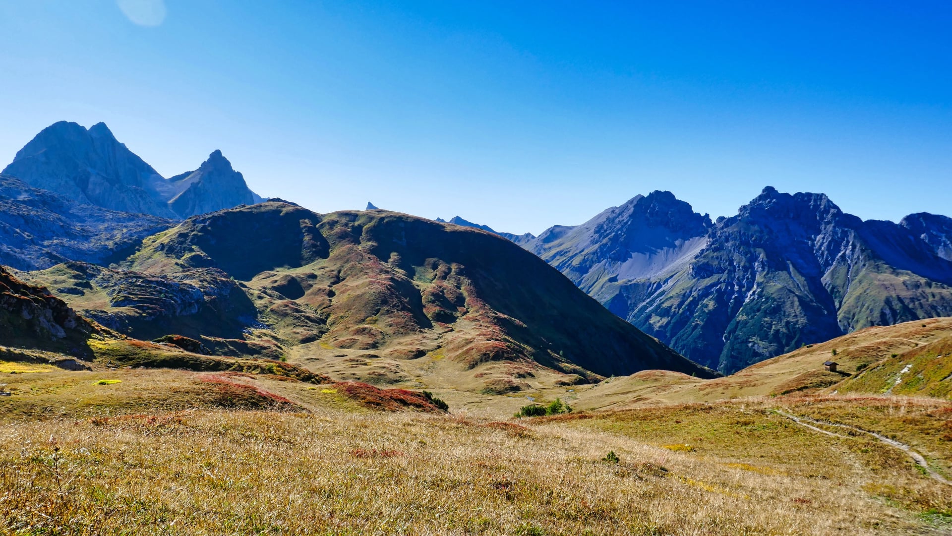
Character: High-altitude, technical, and genuinely wild. Sustained elevation above 2,000m, glacier approaches, remote valleys requiring self-sufficiency, and weather-sensitive passes.
Highlights: Grossvenediger approaches with glacier panoramas, Hohe Tauern National Park wilderness, authentic mountain atmosphere with minimal infrastructure, views of Austria's highest peaks.
Difficulty: Challenging—sustained steep terrain, exposed sections, long stages with significant elevation changes. Requires strong fitness and previous Alpine experience.
Difficulty & What to Expect
Fitness Requirements
To comfortably complete the Adlerweg Highlights, you should:
Hike regularly (weekly or more frequently)
Comfortably manage 12-15km with 1,000m elevation gain in 6-7 hours
Have completed at least one multi-day mountain trek previously
Feel confident on uneven, rocky terrain even when fatigued
Carry 8-10kg comfortably for 6+ hours
Previous Alpine experience is helpful but not mandatory for the Northern Adlerweg sections. The 5-day Highlights route works well as an introduction to serious Alpine trekking for fit hikers with basic mountain experience.
Comparison to other routes: The Northern Adlerweg is less technical than Alta Via 2 in the Dolomites, for example, or Swiss high routes but more challenging than most valley-based multi-day hikes. The Eastern Adlerweg approaches the difficulty of demanding Alpine traverses and requires stronger technical skills.
Terrain Types on the Adlerweg
The Adlerweg crosses remarkably varied terrain, creating daily diversity that keeps hiking interesting:
Forest paths and cart tracks (40%): Wide, well-maintained trails through beech and spruce forests, gaining elevation gradually on switchbacks
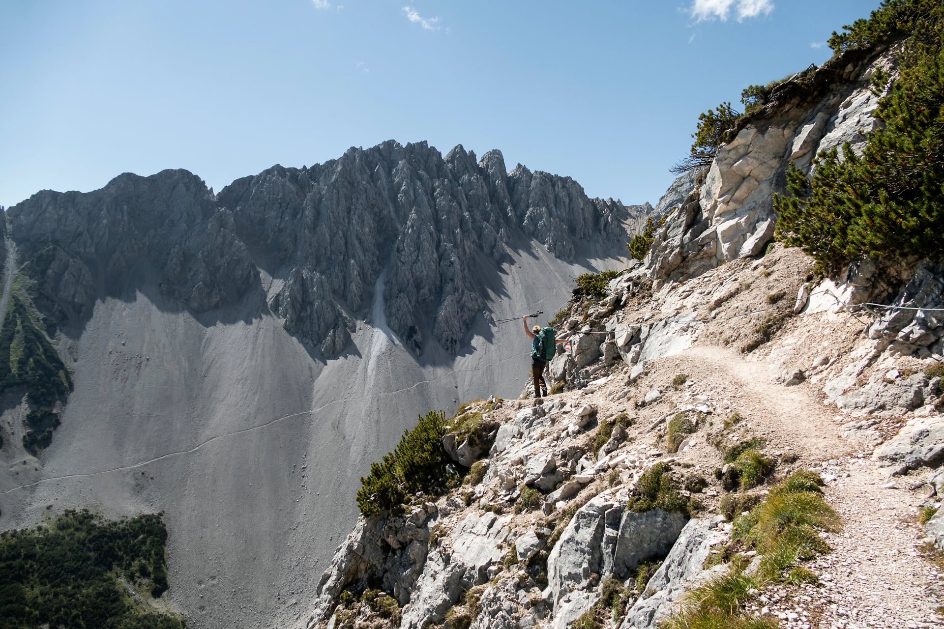
Rocky Alpine trails (35%): Narrower mountain paths on limestone and schist, requiring attention to footing, especially when wet
Exposed ridges with scrambling (20%): Sections demanding use of hands for balance, steel cables for handholds on steeper passages, significant drop-offs
Road and valley sections (5%): Brief stretches on paved or gravel surfaces connecting mountain stages
Daily Challenges
Typical stage characteristics:
Elevation gain: 800-1,200m most days, occasionally exceeding 1,200m on demanding stages
Distance: 12-18 km per stage (shorter in mountains, longer in valleys)
Hiking time: 5-8 hours daily including breaks
Exposure: Moderate to significant on Karwendel ridges—comfort with height essential
Physical demands: The Adlerweg requires strong cardiovascular fitness for sustained uphill effort carrying 8-10kg packs. Knee strength matters for long descents on rocky terrain. Multi-day endurance is critical—you'll hike consecutive days without rest, meaning recovery happens overnight at huts rather than full rest days.
Technical Sections
The standard Adlerweg route does not require via ferrata equipment—there are no ladder sections or sustained cable-protected climbing. However, some sections do feature:
Steel cables for handholds: Short sections where cables assist balance and provide security on exposed passages, particularly in the Karwendel
Scrambling required: Occasional use of hands on rock for upward progress or balance, especially on ridge sections
Exposure: Narrow paths with significant drop-offs to one or both sides—generally well-maintained but requiring concentration
These technical sections are avoidable for hikers uncomfortable with exposure—alternative routes exist for most exposed passages, though they may add distance or elevation.
Best Time to Hike the Adlerweg
Austrian Alpine weather and mountain hut schedules determine the Adlerweg hiking season. Conditions change significantly throughout summer and shoulder seasons, affecting trail accessibility, hut availability, and your hiking experience.
Our Recommendation
Late June (final 10 days) or first three weeks of September offer optimal conditions. You'll experience:
Excellent weather with stable patterns
Manageable crowds (not empty, but not overwhelmed)
All huts open and operating
Comfortable temperatures for strenuous uphill effort
Lower prices than peak August
Avoid early June (snow on passes) and late September (hut closures, early snow risk) unless you're flexible with itineraries and experienced with variable conditions.
For comprehensive weather patterns and what to expect throughout the year, see our Weather Guide for Hiking in Austria.
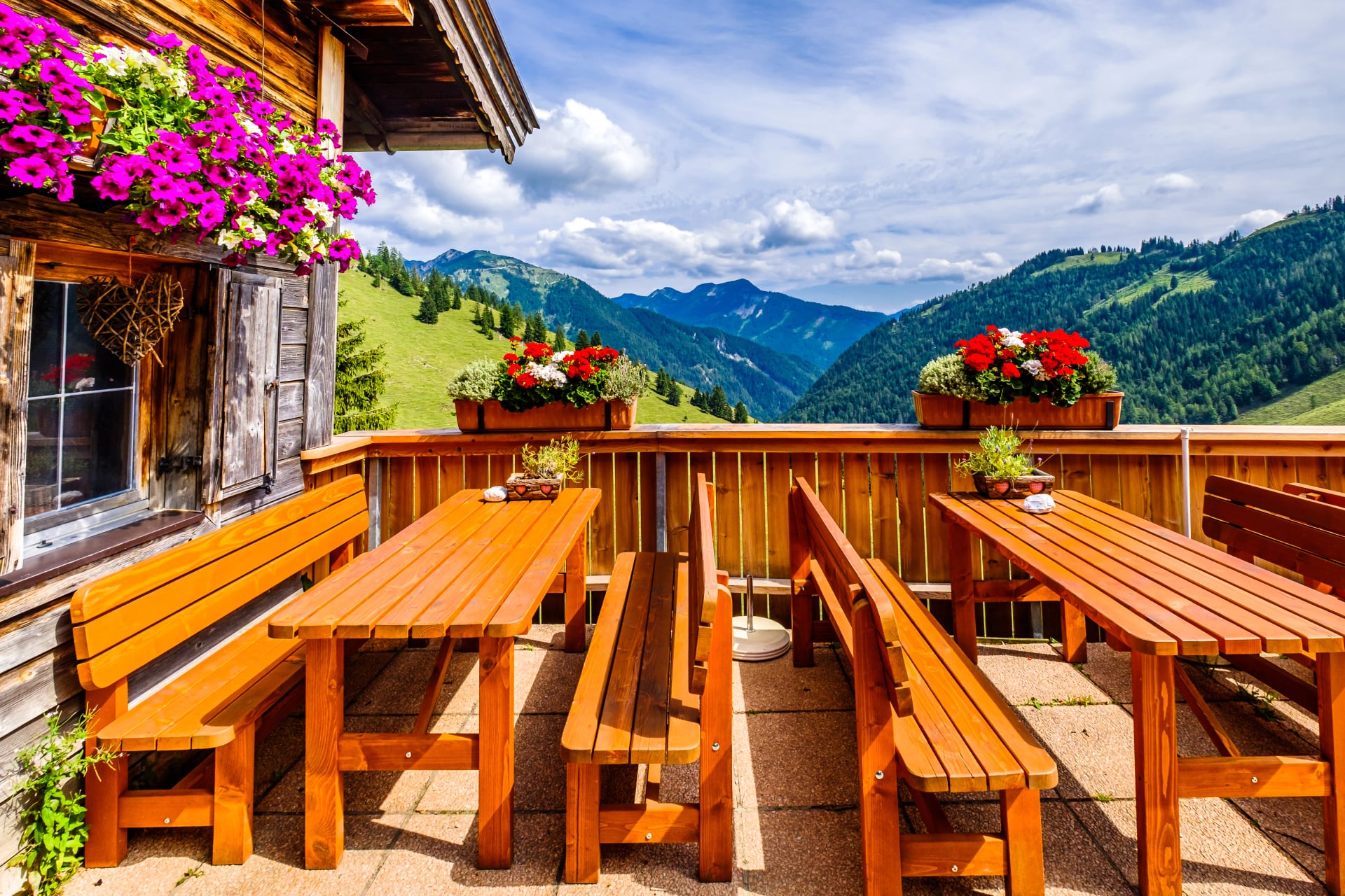
Mountain Huts Along the Adlerweg
The Adlerweg's mountain hut network makes multi-day trekking logistically simple and culturally rewarding. Every stage ends at a hut or guesthouse providing meals, beds, and the warm hospitality Tyrol is famous for. These aren't merely functional accommodations—they're destinations offering authentic Alpine atmosphere, spectacular positioning, and the social experience of shared mountain meals.
Hut Operations & Booking
Season: Most Adlerweg huts operate mid-June through late September, with exact dates varying by elevation and snowpack. Higher huts (above 2,200m) may not open until late June.
Reservations: Essential during July-August peak season. Book 2-3 months in advance for popular Karwendel huts. Shoulder season (June, September) allows booking 6-8 weeks ahead with good availability, though weekends still fill quickly.
Half-board is standard: Overnight stays include dinner and breakfast. Dinners are hearty multi-course meals showcasing Tyrolean cuisine—soups, schnitzel, dumplings (Knödel), goulash, and local specialties. Breakfasts provide bread, cheese, cold cuts, jam, coffee, and tea.
Cash required: Most mountain huts operate cash-only for accommodation and drinks. Budget €60-90 per person per night for half-board plus additional for drinks and snacks.
Austrian Alpine Club membership: Provides 30-50% discounts on hut fees, priority booking during high-demand periods, and mountain rescue insurance. Membership costs €60-80 annually and pays for itself within 3-4 nights.
Featured Huts
These four huts form the backbone of the 5-day Highlights itinerary through the Karwendel, each offering distinct character and spectacular mountain positioning.
For detailed information about mountain huts across all Austrian regions, including booking procedures and what to expect, see our guide to the best huts to stay in different regions of Austria.
Booking Tips
Peak season (July-August): Book 2-3 months ahead, especially for Karwendel section
Shoulder season (June, September): 6-8 weeks usually sufficient
Weekends: Fill faster than weekdays—plan midweek hiking if possible
Confirm dates: Hut opening/closing dates vary by season—verify before finalizing itinerary
Language: Most hut keepers speak German and basic English; booking emails in English are generally understood
Our tours handle all hut booking coordination, securing beds months in advance and managing communication with hut keepers in German, eliminating this time-consuming logistical challenge.
Recommended Itinerary: Adlerweg Highlights (5 Days)
This 5-day route captures the Adlerweg's finest scenery through the heart of the Karwendel Alps, balancing challenging mountain hiking with manageable daily distances. The itinerary follows the classic Adlerweg Highlights line from Pertisau on Achensee (Austria's largest Alpine lake) to Innsbruck, Tyrol's capital city, crossing spectacular limestone ridges and ending with convenient transport connections.
Why this itinerary works:
Achievable length: Fits standard vacation schedules without month-long commitment
Spectacular scenery: Every day delivers dramatic Karwendel landscapes
Excellent infrastructure: Reliable huts, well-marked trails, accessible logistics
Varied terrain: Showcases Adlerweg character from valleys to exposed ridges
Convenient finish: Innsbruck provides excellent onward transport
Day 1 – Arrival in Pertisau
No hiking—arrival and preparation day
Settle into Pertisau, a charming lakeside village on the shores of Achensee. Use the afternoon to explore the lake shore, check gear, purchase any last-minute supplies from the village shop, and enjoy a final restaurant meal before heading into the mountains. Pertisau offers comfortable guesthouses, lake swimming, and beautiful mountain views in all directions.
Day 2 – Pertisau → Karwendelhaus
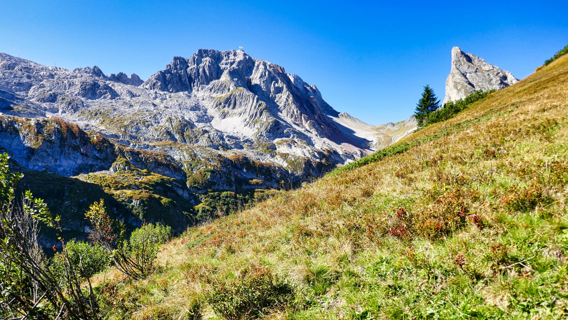
The Adlerweg begins with a steady forest climb from Pertisau toward the Karwendel valley. The trail switchbacks through mixed beech and spruce forest, gaining elevation gradually while opening views back toward Achensee. As you climb higher, the forest transitions to open Alpine meadows and the dramatic Karwendel limestone faces come into view.
The final approach to Karwendelhaus follows the valley floor, surrounded by towering peaks on all sides. The hut's position in this spectacular cirque provides your first taste of genuine Karwendel scenery.
Hiking:
Distance: 14 km
Elevation: +900m / -50m
Time: 5-6 hours
Terrain: Forest switchbacks, then valley approaches through meadows
Accommodation: Karwendelhaus (1,771m)
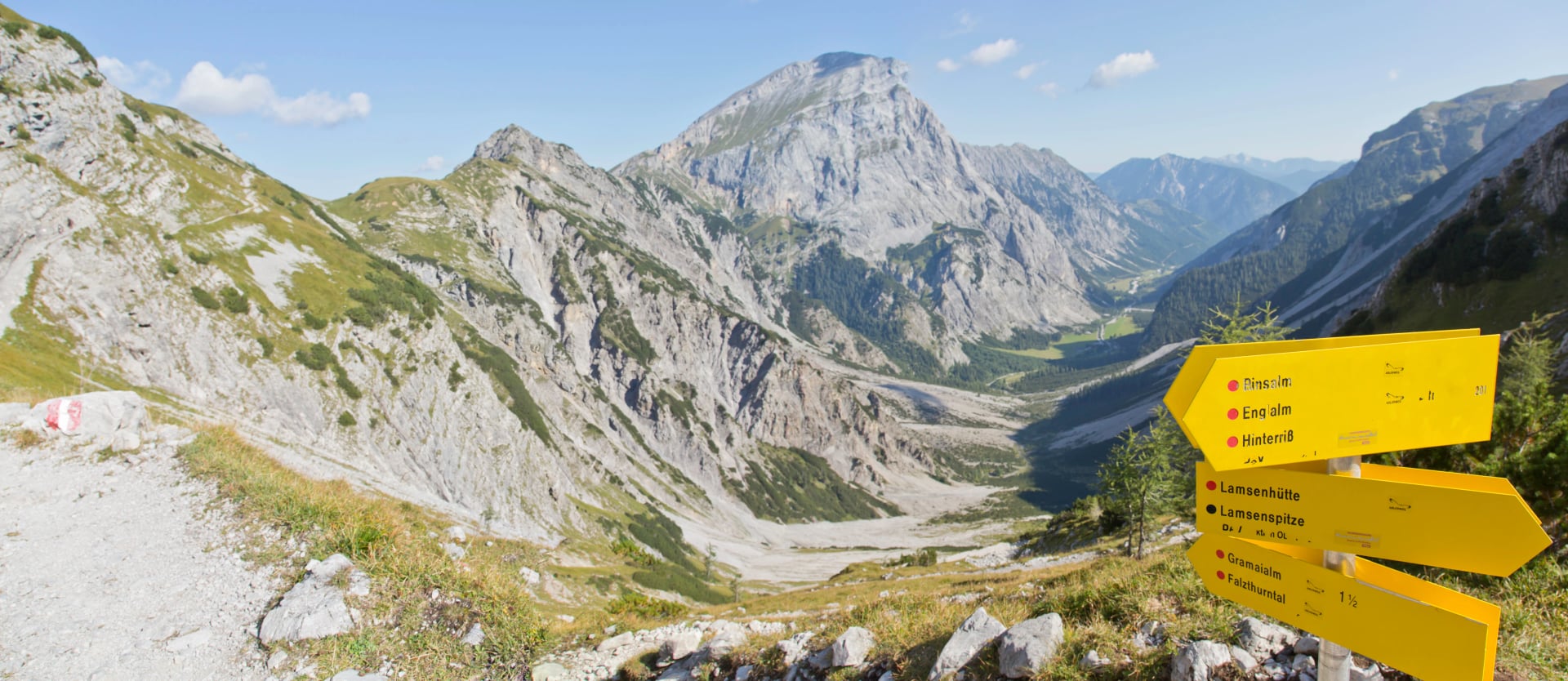
Day 3 – Karwendelhaus → Scharnitz
In terms of ascents, this will be the least demanding day on your tour as you follow the descending Karwendel valley towards Scharnitz. You will take the steadily downhill-sloping path through the forests, following the alpine streams and admiring the two-thousanders rising to each side of the valley.
You will not find any mountain huts along the way, so you should have enough snacks and water for a full-day hike. Exiting the valley, you will reach the Isar river and follow it to the colorful town of Scharnitz, where you will find your accommodation for the night.
Hiking:
Distance: 18 km
Elevation: +80m / -850m
Time: 5-6 hours
Terrain: Valley descent through forests, riverside paths
Accommodation: Gasthof in Scharnitz (valley town)
Day 4 – Scharnitz → Hallerangerhaus
You will commence by following the Isar River through the Hinterautal Valley along the footpath of the Karwendel hut-to-hut trail after some flat kilometers from Scharnitz.
After passing the point where three mountain streams converge to form the mighty Isar River, you will soon reach the Kastenalm hut. You will not get a better chance to rest and grab a bite before the final stretch of today's stage.
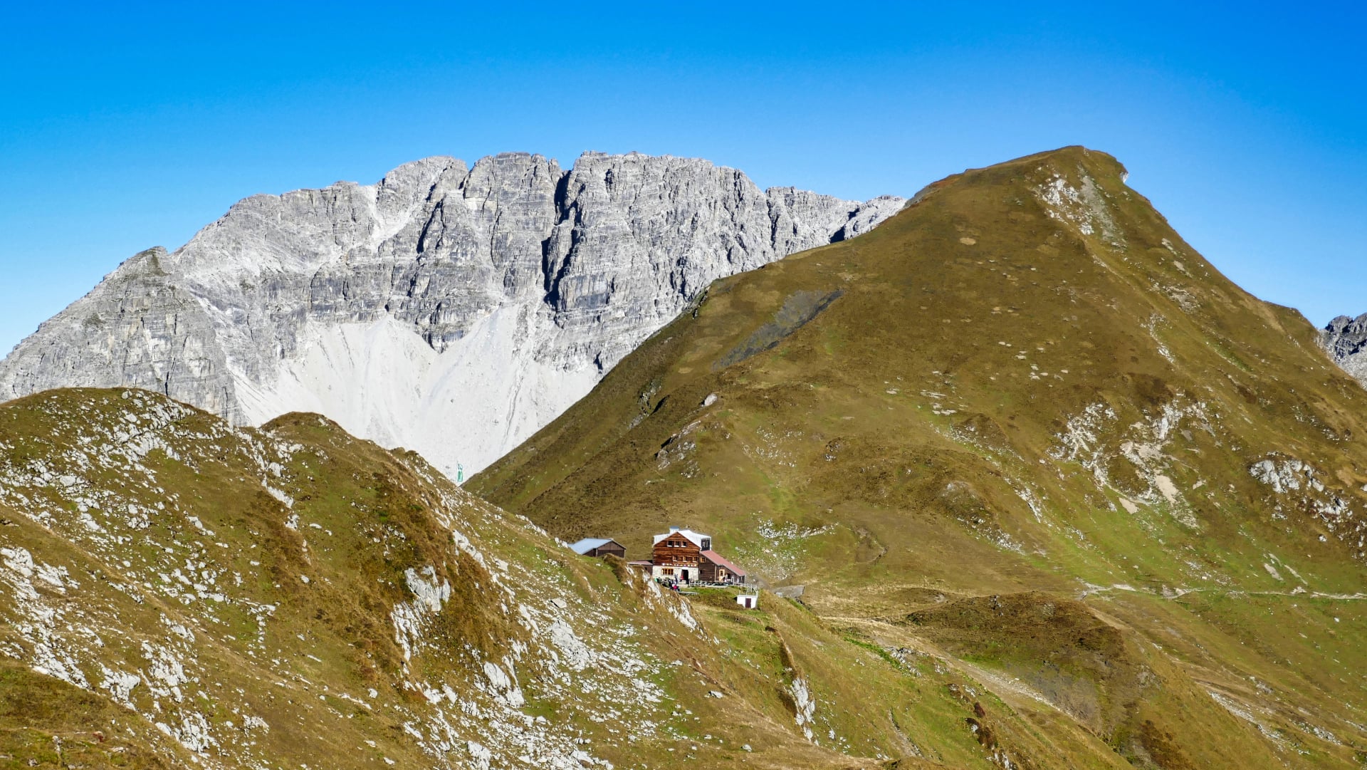
The path gets more vertical here, as you will have to beat nearly 600 meters of elevation before getting to the Hallerangerhaus. You will go to sleep with a magical view of the towering mountain peaks surrounding the hut.
Hiking:
Distance: 19 km
Elevation: +900m / -100m
Time: 6-7 hours
Terrain: Valley floor, then sustained climb to hut
Accommodation: Hallerangerhaus (1,768m)
Day 5 – Hallerangerhaus → Nordkettebahn (Innsbruck)
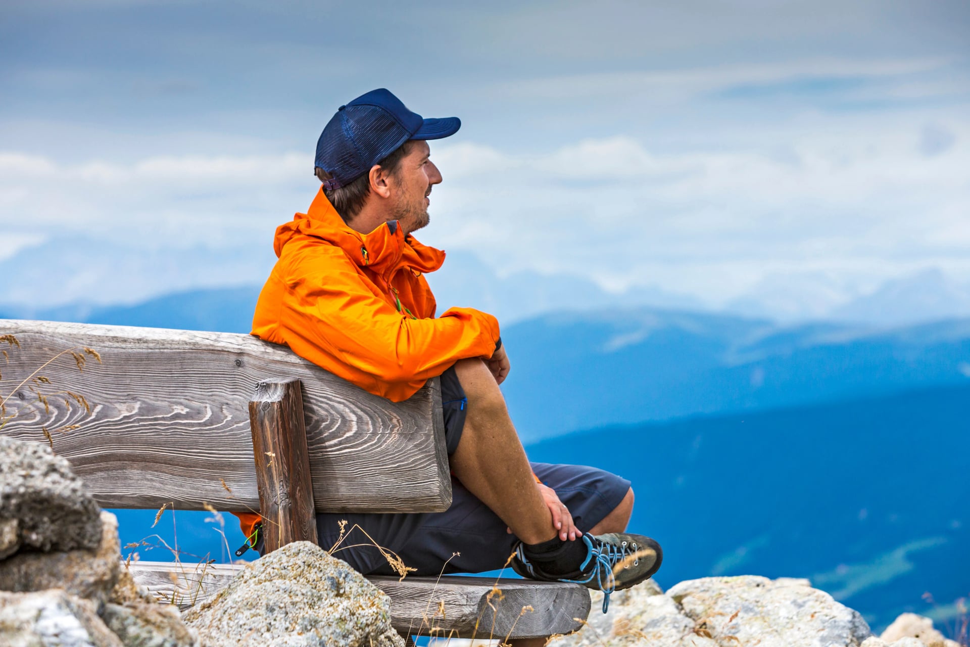
The final day begins with your last climb of the whole tour towards the Lafatscher Joch mountain pass at 2,080m—the highest point of the Adlerweg Highlights. As you hike away from the hut, the path will get narrower and steeper until you are following an old mule track carved into the rock years ago.
Reaching the highest point of the tour at 2,080 meters of elevation will offer some stunning views. You might even see as far as Grossglockner, Austria's highest peak. Afterward, you'll continue toward Pfeishütte, cross a technically challenging scree section with steel cables for assistance, and circle Mandlspitze on your way to Nordkettebahn, where your Adlerweg adventure ends.
From Nordkettebahn, the cable car descends directly into Innsbruck city center in 20 minutes, providing seamless transition from high mountains to urban civilization.
Hiking:
Distance: 13 km
Elevation: +1,100m / -600m
Time: 6-7 hours
Terrain: Steep ascent to pass, exposed ridge with cables, technical scree sections
Finish: Nordkettebahn cable car station → Innsbruck
Who Is This Itinerary For?
Ideal for: Strong hikers who have completed other multi-day mountain routes, those seeking an introduction to Austrian Alpine trekking without month-long commitment, hikers wanting dramatic Karwendel scenery with excellent hut culture.
Not ideal for: First-time mountain hikers without previous multi-day experience, those uncomfortable with exposure or using hands for balance on rock, hikers seeking purely valley-based gentle terrain.
Shorter Alternative
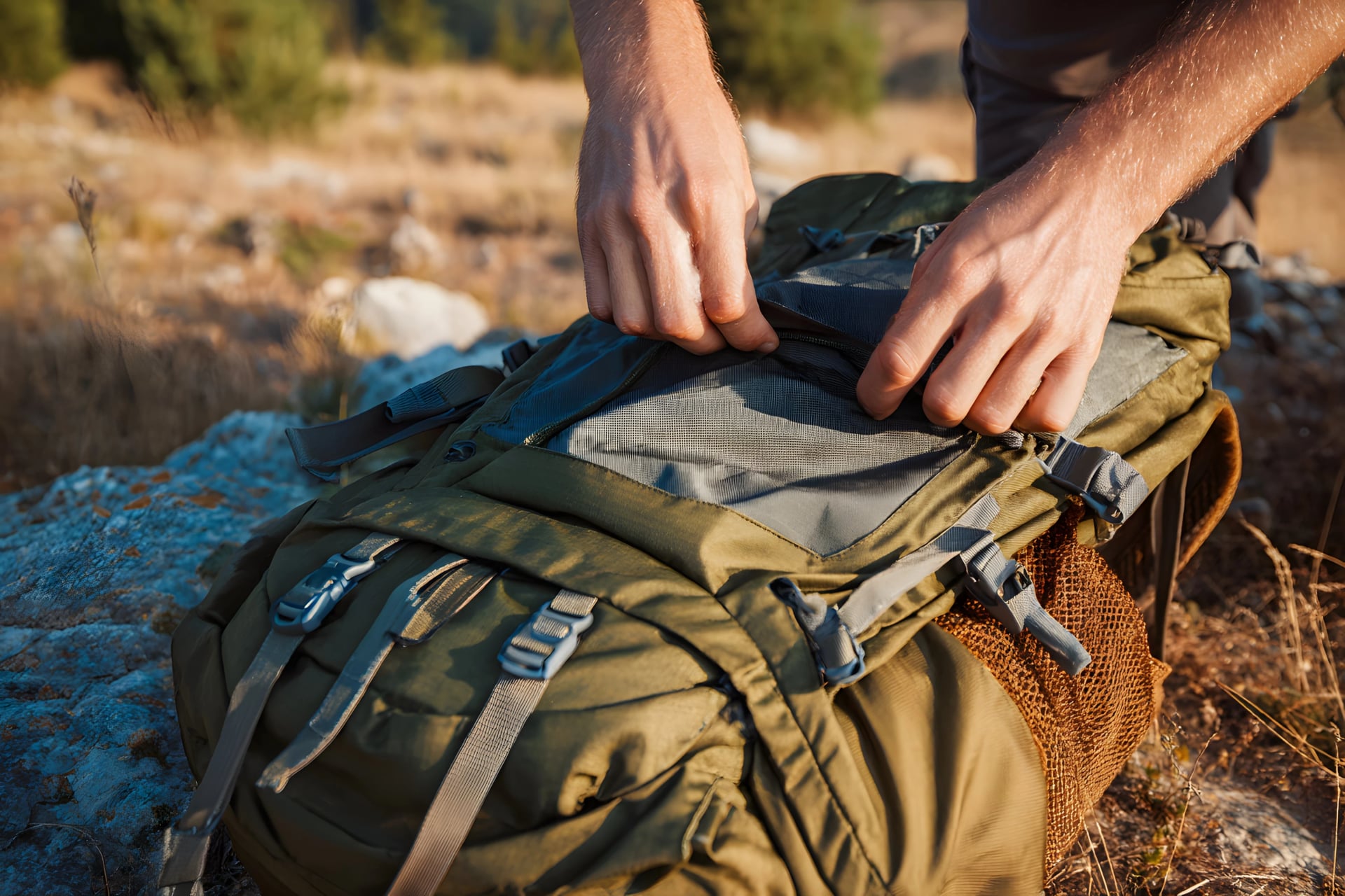
What to Pack for the Adlerweg
The Adlerweg is a hut-to-hut route, so packing focuses on lightweight layers, weather protection, and essential safety items rather than camping gear. Mountain huts provide beds, blankets, and meals—you're carrying only what's needed for daily hiking and overnight hut stays.
Core Clothing Layers
Base layers:
1-2 moisture-wicking shirts (merino wool or synthetic—never cotton)
1 long-sleeve base layer for cold mornings
Mid-layers:
Fleece or lightweight insulated jacket for warmth at huts and during breaks
Down jacket or synthetic puffy for cold mornings and evenings (even in July-August)
Outer layers:
Waterproof shell jacket with hood and taped seams (essential—Alpine storms develop rapidly)
Waterproof pants (full side-zips recommended for easy on/off)
Convertible hiking pants or shorts
Light thermal tights for cold days
Accessories:
Warm hat and gloves (yes, even in summer—high passes get cold)
Sun hat or cap for valley hiking
3-4 pairs hiking socks (merino wool blend recommended)
Buff or neck gaiter for sun/wind protection
Footwear
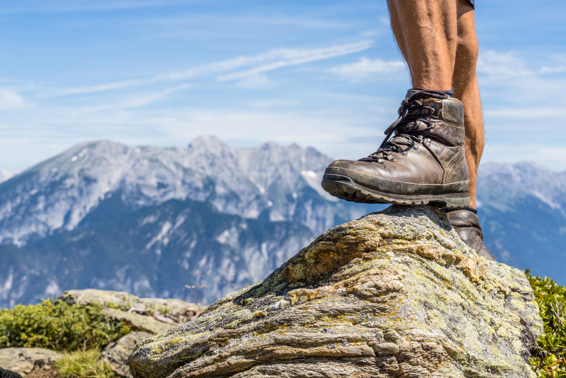
Sturdy hiking boots with good ankle support and aggressive tread (the Karwendel's rocky terrain demands proper footwear)
Hut shoes or sandals for evenings—your feet will thank you
Optional: Lightweight gaiters for early-season snow or loose scree protection
Technical & Safety Gear
Trekking poles (highly recommended—invaluable for steep descents and balance on rocky terrain)
Headlamp with spare batteries for early starts or evening hut use
First aid kit: Blister plasters (Compeed), pain relievers, personal medications, bandages, tape
Emergency items: Whistle, emergency blanket, basic repair kit
Optional: Lightweight helmet if tackling exposed sections in bad weather
Navigation & Communication
Smartphone with offline maps/GPX tracks downloaded
Portable battery pack (10,000mAh minimum)
Paper map as backup (Kompass Karte WK 26 Karwendelgebirge)
Compass (basic navigation backup)
Hydration & Food
2-3 liters water capacity (bottles or hydration bladder)
High-energy snacks for long stages between huts (trail mix, energy bars, dried fruit)
Electrolyte supplements for hot days
Hut Essentials
Sleeping bag liner (mandatory in all Austrian huts—lightweight silk or cotton)
Earplugs (dormitories can be noisy with snoring)
Small wash kit: Toothbrush, toothpaste, biodegradable soap, small towel
Cash (€300-450 for 5-day trek covering hut fees, drinks, snacks)
Miscellaneous
Sun protection: Sunglasses (UV protection), high-SPF sunscreen, lip balm
Documents: Passport or ID, insurance card, Austrian Alpine Club membership if applicable
Small backpack (25-35 liters sufficient for hut-to-hut)
Weight Target
Aim for 8-10kg total pack weight (without water). Staying within this range keeps long climbs manageable while covering all essentials. Avoid duplicate clothing and heavy "just in case" items. Prioritize versatile layers that dry quickly and can be combined for colder conditions.
For comprehensive packing guidance covering all seasons and route types, see the detailed packing section in our ultimate guide to hut-to-hut hiking in Austria.
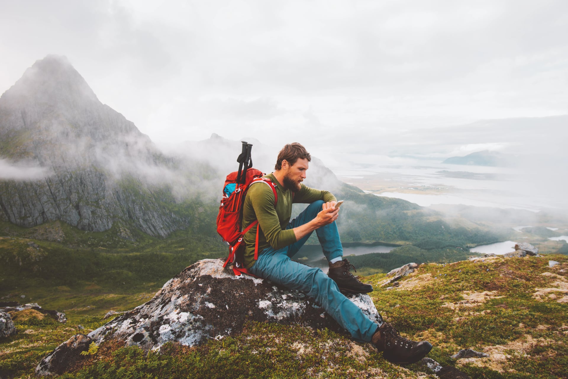
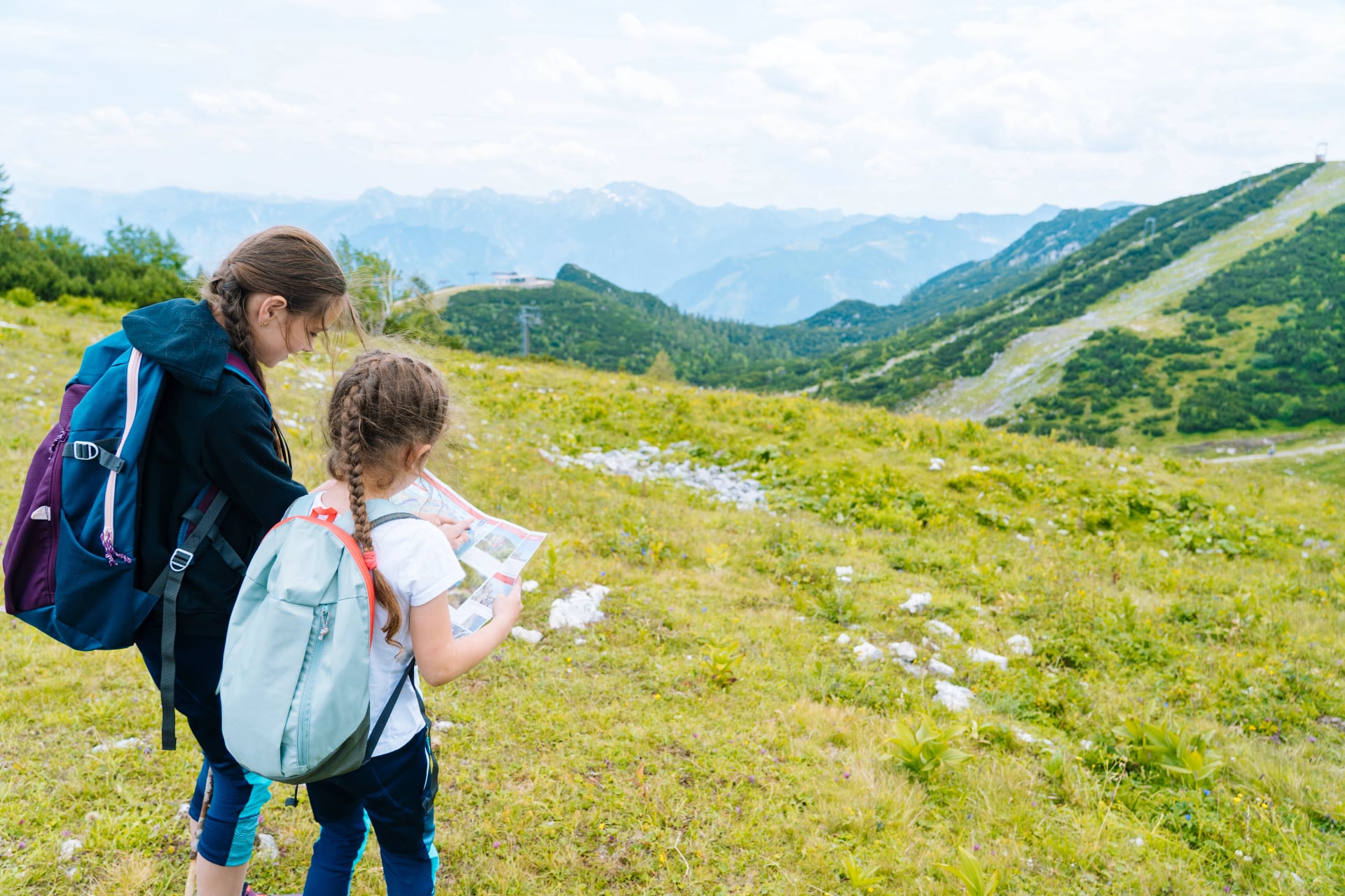
Navigation & Safety on the Adlerweg
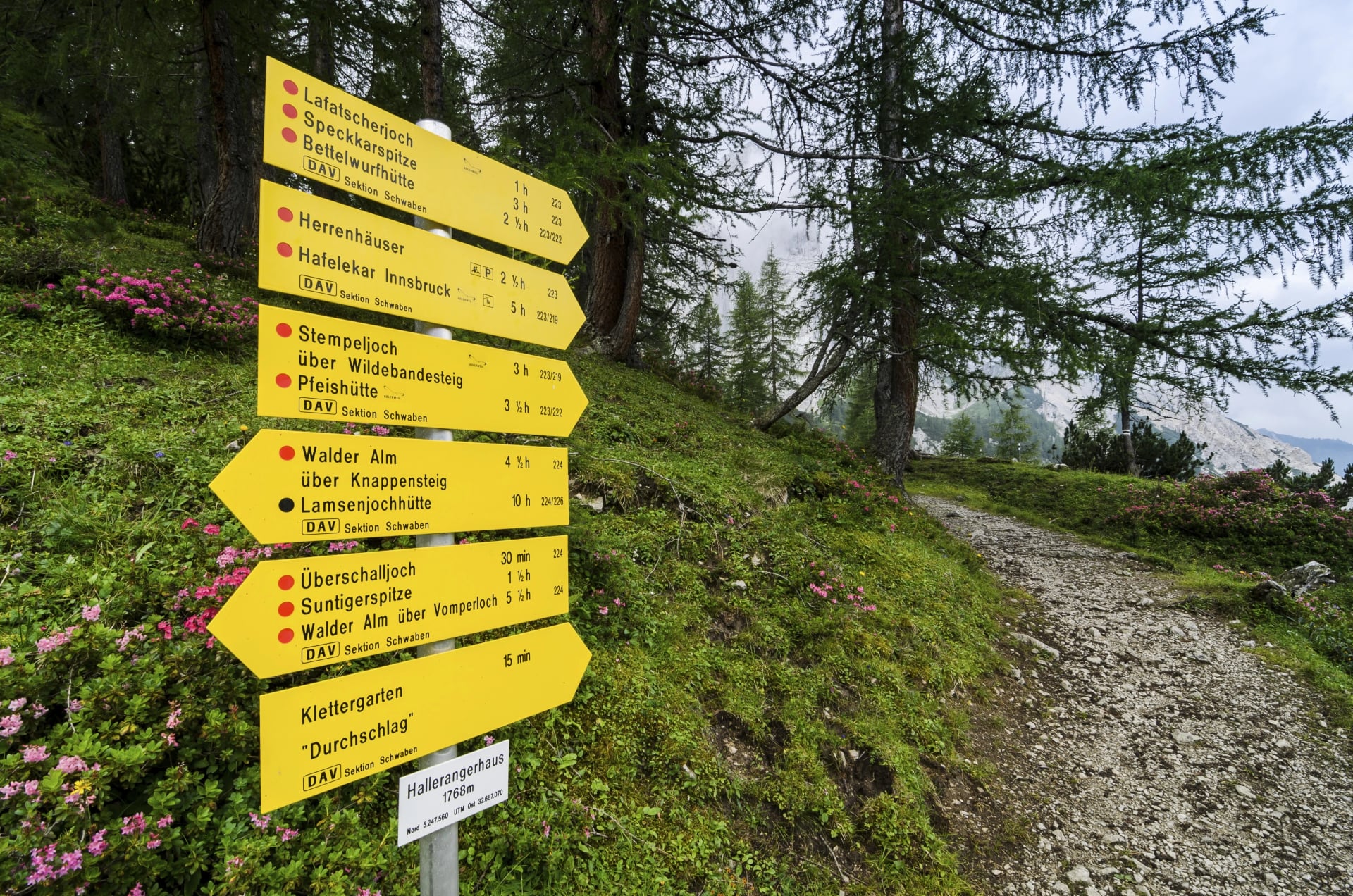
The Adlerweg is exceptionally well-marked and navigating it is straightforward for hikers familiar with European trail systems. However, the Alpine environment requires attention, preparation, and reliable backup tools.
Trail Marking System
The combination creates a robust marking system—you're unlikely to get lost in good conditions if paying attention. However, fog, late-season snow, and rocky terrain can make markers harder to see, making GPS backup essential.
Weather Considerations
Afternoon thunderstorms are common throughout July-August. Storms develop with remarkable regularity—clear morning skies can transform into electrical storms by 2-3 PM. Always start hiking early (7-8 AM) to reach your destination before the weather deteriorates.
Check forecasts daily at huts before departing. Hut keepers monitor weather closely and provide reliable local advice about conditions on the day's route.
Reliable Weather Sources
Safety Guidelines
1. Weather changes rapidly: Conditions above 2,000m can shift within an hour. Carry waterproof layers even on seemingly stable days.
2. Early-season snow persists: High passes may have snow patches through June, creating slippery conditions and obscuring trail markers.
3. Exposure on Karwendel sections: Some ridge segments have significant drop-offs and require sure-footedness. Steel cables provide handholds but don't eliminate exposure.
4. Never continue in severe weather: If caught in electrical storms, descend immediately to lower elevations or seek shelter at nearest hut. Don't cross exposed ridges during lightning.
5. Carry navigation backup: Phone batteries drain faster at altitude. Download GPX tracks and bring portable battery plus paper map.
6. Solo hiking is possible: Trails are well-marked and other hikers are common during season, but solo travelers should be especially cautious with weather decisions and inform hut staff of their plans.
Emergency Situations
General emergency: 112 (EU-wide emergency number, works from any phone)
Mountain rescue: 140 (Austria-specific mountain rescue)
Alpine Club emergency: If you're an Austrian Alpine Club member, rescue insurance is included—inform rescuers of membership
Hut refuge: If conditions turn dangerous, the nearest hut provides shelter. Never attempt to push through severe weather to reach your planned destination—safety always trumps schedule.
Difficulty Assessment
Be honest about your abilities. The Adlerweg Highlights includes:
Sustained daily elevation gain (800-1,100m)
Loose scree and rocky terrain
Narrow ridge sections with exposure
Steel cable-assisted passages (not via ferrata but requiring confidence)
Long days (6-7 hours typical)
Choose the Adlerweg only if comfortable with these demands. Alternative routes exist—speak with us about options better suited to your experience level if uncertain.
Food, Water & Resupply
Meals at Mountain Huts
Half-board (Halbpension) is standard for mountain hut stays and provides the best value. This includes:
Dinner: Multi-course alpine meals served 6-8 PM. Expect hearty Tyrolean cuisine—soups (often Gulaschsuppe or clear broths), main courses (schnitzel, goulash, Knödel dumplings, pasta), and sometimes desserts. Portions are generous and designed for hungry hikers. Most huts serve family-style at communal tables, creating social atmosphere.
Breakfast: Continental spread served 7-8 AM with bread, butter, jam, cheese, cold cuts, coffee, and tea. Sufficient for fueling morning starts but not elaborate.
Dietary accommodations: Most huts handle vegetarian requests with advance notice. Vegan, gluten-free, and allergy accommodations are more challenging but possible—communicate clearly when booking.
Austrian Dishes to Try
Water on Trail
Carry 2-3 liters capacity per day. Water weight adds up, but better to carry extra than run out on hot climbs.
Refill at huts each morning before departing. Some huts provide free water; others charge small amounts (€1-2 for refills).
Mid-route water sources vary by stage. Some days feature streams or fountains; others offer no refills between huts. Check with hut staff before departing about water availability on your day's route.
High summer warning: August heat can be intense. On hot days with sustained climbing, consider carrying 3 liters to avoid dehydration.
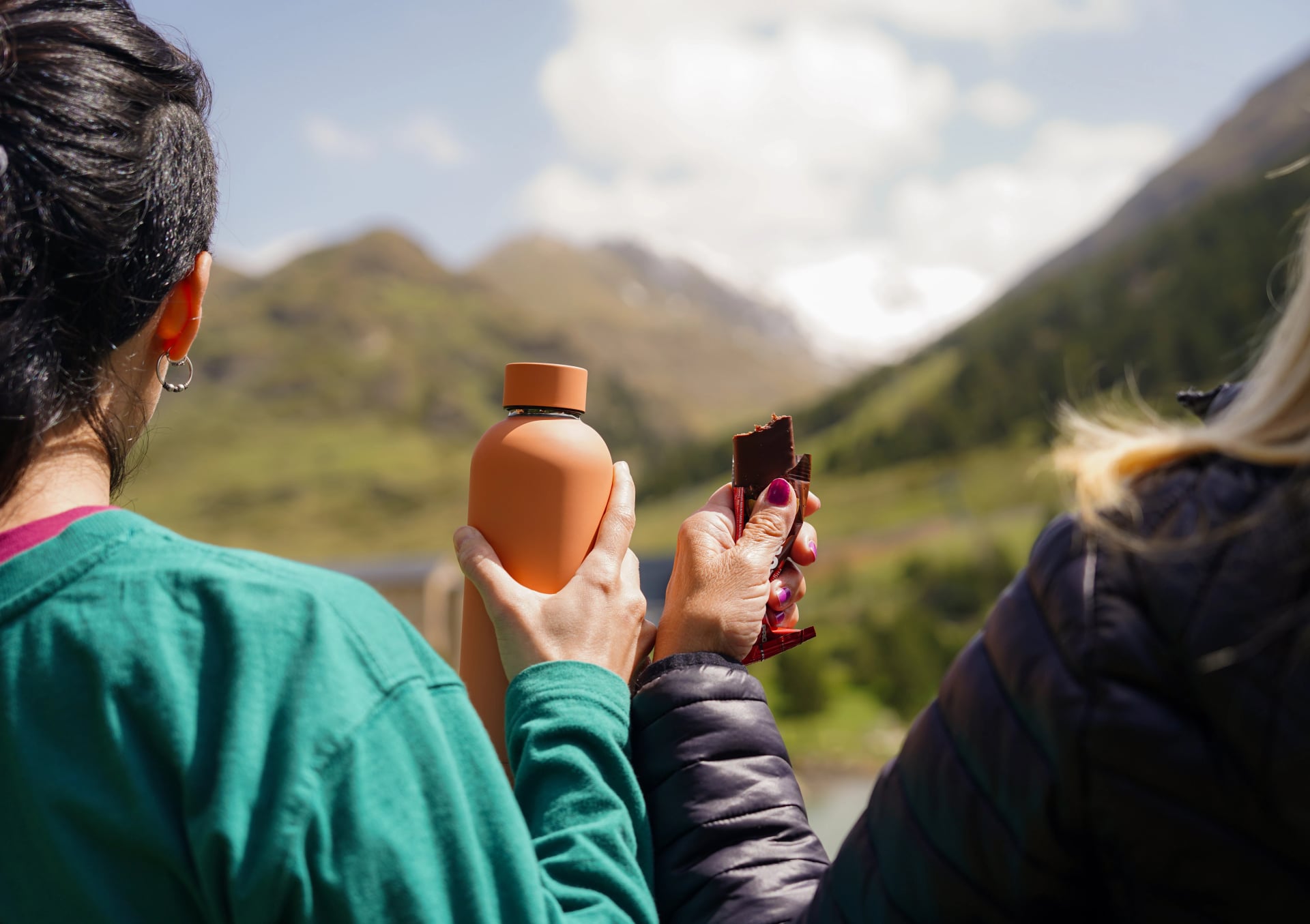
Snacks & Lunch
Packed lunches are available at most huts—order the evening before. Typical contents: sandwich (panini), piece of fruit, energy bar, sometimes chocolate or cookies. Cost: approximately €8-12.
Bring personal snacks: Trail mix, energy bars, dried fruit, or other high-calorie foods from valley towns. Many stages have no facilities between morning departure and afternoon arrival, making self-sufficiency important.
Mid-route hut stops: Some stages pass huts convenient for lunch breaks. Kastenalm (Day 4) is an example. Budget extra for these opportunistic stops.
Guided vs Self-Guided on the Adlerweg
The Adlerweg Highlights is achievable as either guided or self-guided, with the right choice depending on your Alpine experience, navigation confidence, and preference for independence versus support.
Self-Guided Adlerweg
Who it's for:
Experienced hikers comfortable with mountain navigation
Those wanting complete flexibility in daily pacing
Confident with Austrian trail systems and hut culture
Hikers seeking independent mountain experience
Budget-conscious travelers
Pros:
Complete flexibility: Stop when you want, adjust rest breaks, modify daily schedule
More affordable: Lower cost than guided options
Customize rest days: Take extra time at favorite locations
Personal adventure: Stronger sense of self-reliance and accomplishment
Cons:
Navigation responsibility: You handle route-finding (though trails are well-marked)
Weather decisions: You determine when conditions are safe to proceed
Hut booking coordination: Must arrange all accommodations independently
Problem-solving: Handle logistical issues yourself
Guided Adlerweg
Who it's for:
First-time Alps hikers wanting expert leadership
Those preferring professional guidance through technical sections
Hikers valuing social group experience
Anyone prioritizing safety and local knowledge over independence
Travelers who prefer logistics handled by professionals
Pros:
Expert leadership: Guide handles navigation, weather decisions, and safety
Local knowledge: Insights about flora, fauna, geology, Tyrolean culture
Social atmosphere: Shared experience with like-minded hikers
Safety buffer: Professional support in challenging conditions
Zero logistics stress: Everything coordinated professionally
Cons:
Higher cost: Guiding services increase overall price
Fixed pace: Group moves together at compromise speed
Less flexibility: Predetermined schedule with limited adjustment options
Shared experience: Less opportunity for solitude
Disclaimer: our Adlerweg Highlights tour package comes solely in the self-guided option.
Getting To & From the Adlerweg
The Adlerweg Highlights starts in Pertisau (Achensee region) and finishes at Nordkettebahn in Innsbruck, both well-connected to major airports and rail networks.
Getting to the Start (Pertisau)
Getting Back From the Finish (Innsbruck)

The Adlerweg Highlights finishes at Nordkettebahn cable car station, which connects directly to Innsbruck city center in 20 minutes. From Innsbruck Hauptbahnhof (main train station), excellent connections reach all major airports:
To Munich Airport:
Train: Innsbruck → Munich (2 hours) → S-Bahn to airport (45 minutes)
Total: ~3 hours
To Innsbruck Airport:
Bus: 15 minutes from city center
Most convenient finish for onward flights
To Salzburg Airport:
Train: Innsbruck → Salzburg (2 hours) → bus to airport (20 minutes)
Total: ~2.5 hours
To Zürich Airport:
Train: Innsbruck → Zürich (3.5-4 hours)
Good option for western-bound travelers
Useful Transport Websites
ÖBB (Austrian Railways) - National rail network for tickets and schedules
Postbus (ÖBB Postbus) - Regional buses throughout Tyrol
DB (German Railways) - German railways, useful for Munich connections
Südtirolmobil - South Tyrol transport (relevant for some Adlerweg sections)
Private transfers available: If your arrival/departure times don't align with public transport schedules, we can arrange private transfers. Contact us for details and pricing.
Frequently Asked Questions
Q: Do I need previous hiking experience for the Adlerweg?
A: Yes. The Adlerweg Highlights requires strong fitness and previous multi-day mountain experience. While not extremely technical, the route demands comfort with sustained uphill effort, rocky terrain, and occasional exposure. Beginners should start with shorter, less demanding routes before attempting the Adlerweg.
Q: Can beginners do the Adlerweg Highlights?
A: Not comfortably. While fit beginners with some mountain experience might manage, the sustained daily elevation (800-1,100m) and 6-7 hour days make it challenging for those new to Alpine hiking. Consider our 3-day introductory routes first to build experience.
Q: Is the Adlerweg well-marked?
A: Yes, exceptionally. Yellow eagle logos plus standard red-white-red Austrian trail markers appear throughout. Wooden signposts mark junctions. GPS backup is still recommended for bad weather, but navigation is straightforward in good conditions.
Q: How difficult is the Adlerweg compared to other routes?
A: The Northern Adlerweg (including Highlights) is less technical than Alta Via 2 or Swiss high routes but more challenging than valley-based multi-day hikes. It sits in the "moderate to challenging" category—demanding fitness without extreme technical skills.
Q: Can I hike the Adlerweg solo?
A: Yes. Trails are well-marked, huts frequent, and other hikers common during season. Solo travelers should be especially careful with weather decisions and navigation backup. Inform hut staff of your plans each morning.
Q: Do I need via ferrata equipment?
A: No. The standard Adlerweg Highlights route requires no via ferrata gear. Some sections have steel cables for handholds on exposed passages, but these are brief and don't require clipping in. Confident hikers complete the route without specialized equipment.
Q: What's the longest/hardest day?
A: Day 5 (Hallerangerhaus to Innsbruck) is typically most challenging: 1,100m elevation gain, 13 km, exposed ridge sections with scree, and technical passages with steel cables. Allow 6-7 hours.
Q: What if weather turns bad?
A: Descend to the nearest hut and wait. Never cross exposed ridges during electrical storms. Huts provide safe shelter, and itineraries can be adjusted. Your safety is more important than schedule.
Q: Are huts vegetarian-friendly?
A: Most offer basic vegetarian options with advance notice. Selection is more limited than omnivore meals, but manageable. Bringing supplementary snacks is wise for specific dietary needs.
Q: How do I get back to my starting point?
A: The Adlerweg Highlights is point-to-point (Pertisau to Innsbruck). Return to Pertisau via bus from Innsbruck if needed, or plan onward travel from Innsbruck to airports/home. Most hikers don't return to the start.
What Our Tours Include
Our Adlerweg tours eliminate planning stress while preserving the adventure and accomplishment of hiking Austria's legendary Eagle's Path. Here is what you can expect:
Complete hut booking coordination with confirmed reservations months in advance
Detailed stage-by-stage itineraries with route descriptions, elevation profiles, and estimated times
GPS tracks for every stage, downloadable to your device before departure
Luggage transfer options where available (Scharnitz to Innsbruck for valley section)
Booking transport from/to airports and trailheads with clear instructions
24/7 emergency support during your trek via phone and email
Local expertise on conditions, weather patterns, and route variants
Pre-departure consultation ensuring the route matches your fitness and experience level
Whether you choose our 5-day Adlerweg Highlights or inquire about custom longer sections, we handle the logistics so you focus entirely on the experience.
Ready to Conquer Adlerweg?
The Eagle's Path represents Austrian Alpine hiking at its finest—dramatic Karwendel scenery, authentic mountain hut culture, well-marked trails, and the satisfaction of completing a legendary route across Tyrol's heartland.
Looking for something else? See our other tours to see our complete offerings and seasonal availability.
Schedule a free consultation to discuss which itinerary suits your experience level, fitness, and adventure goals. We'll help you plan the perfect Austrian Alpine experience.

.svg)
VALUE YOUR TIME
With everything on your plate, let us handle the vacation planning, so your valuable time stays exactly where you need it.
.svg)
TRIED & TESTED ADVENTURES
Only the best hut to hut hikes of Austria, cherry-picked by our local team with an in-depth knowledge of the region.
TRUSTED BY MANY
We are a financially protected company operating since 2014, and with thousands of satisfied customers in the past, we still put you first.

SELF-GUIDED TRAVEL
Explore independently and with confidence while we keep everything running from behind the scenes.
.svg)
OUTDOOR SPECIALISTS
We are a team of outdoor specialists equipped with the knowledge and insight to bring you the best hiking experiences.